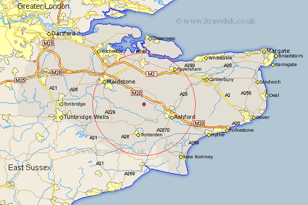
Kent Map Showing Location of Egerton
Population: 1104
District: Ashford
Easting: 591006 Northing: 146283
Latitude: 51.18 Longitude: 0.73
 = Egerton
District: Ashford
Easting: 591006 Northing: 146283
Latitude: 51.18 Longitude: 0.73
= Egerton
This Egerton map below is supplied by Google. Use the tools in the top left corner to zoom into street level or zoom out for a road map, you may also need to zoom in to see Egerton on the map. Click and drag the map to move around. If the map fails to load try and refresh your browser or zoom in or out (+ or -).
Update - it seems Google no longer allow people to use their maps for free! This Egerton map sometimes loads and sometimes gives a error. I am working on a solution.
Closest 30 Towns or Cities to Egerton (Population over 500)
Pluckley 1.16km Charing 5km Lenham 5.68km Ulcombe 6.1km Harrietsham 6.56km Smarden 6.56km Hothfield 6.89km Bethersden 7.76km Headcorn 8.94km Hollingbourne 9.42km Doddington 9.56km Leeds 9.85km Sutton Valence 10.62km Shadoxhurst 10.94km Kennington 11.09km High Halden 11.18km Biddenden 11.6km Langley 11.84km Ashford 11.85km Frittenden 11.85km Kingsnorth 12.33km Woodchurch 13.17km Bredgar 13.18km Tenterden 13.25km Linsted 13.44km Lynsted 13.44km Wye 13.94km Boughton Monchelsea 14.42km Staplehurst 14.43km Bearsted 14.85km