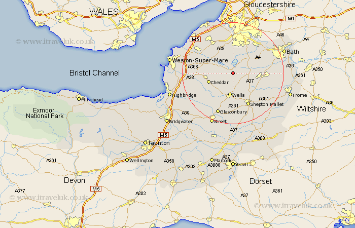
Somerset Map Showing Location of East Harptree
Population: 680
Easting: 355851 Northing: 155899
Latitude: 51.3 Longitude: -2.63
 = East Harptree
Easting: 355851 Northing: 155899
Latitude: 51.3 Longitude: -2.63
= East Harptree
This East Harptree map below is supplied by Google. Use the tools in the top left corner to zoom into street level or zoom out for a road map, you may also need to zoom in to see East Harptree on the map. Click and drag the map to move around. If the map fails to load try and refresh your browser or zoom in or out (+ or -).
Update - it seems Google no longer allow people to use their maps for free! This East Harptree map sometimes loads and sometimes gives a error. I am working on a solution.
Closest 30 Towns or Cities to East Harptree (Population over 500)
Compton Martin 1.16km Chewton Mendip 5.08km Chew Stoke 5.56km Blagdon 6.87km Farrington Gurney 7.2km Great Chew 7.51km Chew Magna 7.51km Clutton 7.87km Temple Cloud 8.23km Rodney Stoke 8.91km Paulton 9.27km Winford 9.33km Wells 9.34km Westbury 9.41km Farmboro 9.98km Farmborough 9.98km Stratton 9.99km Stratton on the Fosse 9.99km Stratton-on-the-Fosse 9.99km Chilcompton 9.99km Cheddar 9.99km Publow 10.16km Timsbury 10.59km Priddy 10.81km Dundry 11.12km Shipham 11.59km Wookey 11.65km Axbridge 11.74km Wrington 11.87km Whitchurch 12.04km