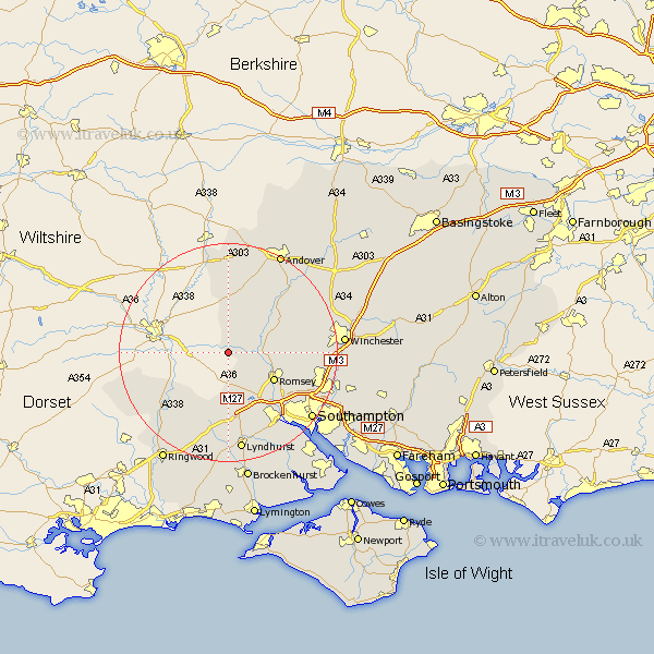
Hampshire Map Showing Location of East Dean
Population: 200
District: Test Valley
Easting: 426876 Northing: 126122
Latitude: 51.03 Longitude: -1.62
 = East Dean
District: Test Valley
Easting: 426876 Northing: 126122
Latitude: 51.03 Longitude: -1.62
= East Dean
This East Dean map below is supplied by Google. Use the tools in the top left corner to zoom into street level or zoom out for a road map, you may also need to zoom in to see East Dean on the map. Click and drag the map to move around. If the map fails to load try and refresh your browser or zoom in or out (+ or -).
Update - it seems Google no longer allow people to use their maps for free! This East Dean map sometimes loads and sometimes gives a error. I am working on a solution.
Closest 30 Towns or Cities to East Dean (Population over 500)
Sherfield English 6.03km Broughton 7.25km West Wellow 7.76km Michlemersh 8.16km Michelmersh 8.16km Romsey 9.88km Nether Wallop 9.91km Kings Somborne 10.03km Bramshaw 11.12km Over Wallop 11.18km Stockbridge 11.91km Hale 12.35km Cadnam 13.17km Hursley 15.27km Totton 15.98km Minstead 16.72km Sparsholt 16.73km Chilworth 16.78km Fordingbridge 16.98km Goodworth Clatford 17.51km Clatford 17.51km Lower Clatford 17.51km Eling 17.52km Abbots Ann 18.08km Abbotts Ann 18.08km Chilbolton 18.23km Lyndhurst 18.67km Thruxton 18.68km Otterbourne 19.02km Upper Clatford 19.1km