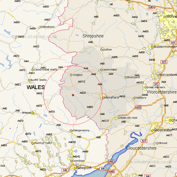
Herefordshire Map Showing Location of Dorstone
Population: 318
Easting: 331458 Northing: 241443
Latitude: 52.07 Longitude: -3
 = Dorstone
Easting: 331458 Northing: 241443
Latitude: 52.07 Longitude: -3
= Dorstone
This Dorstone map below is supplied by Google. Use the tools in the top left corner to zoom into street level or zoom out for a road map, you may also need to zoom in to see Dorstone on the map. Click and drag the map to move around. If the map fails to load try and refresh your browser or zoom in or out (+ or -).
Update - it seems Google no longer allow people to use their maps for free! This Dorstone map sometimes loads and sometimes gives a error. I am working on a solution.
Closest 30 Towns or Cities to Dorstone (Population over 500)
Peterchurch 5.05km Eardisley 7.41km Clifford 7.77km Almeley 9.33km Madley 10.91km Kingstone 12.68km Credenhill 14.16km Weobley 14.37km Kington 14.87km Lyonshall 14.87km Ewyas Harold 15.24km Allensmore 15.83km Dilwyn 15.84km Burghill 16.37km Pembridge 18.02km Moreton 18.59km Moreton on Lugg 18.59km Moreton-on-Lugg 18.59km Wellington 18.61km Much Dewchurch 19.46km Hereford 19.46km Eardisland 19.57km Bullingham 19.73km Sutton 21.95km Shobdon 22.32km Much Birch 22.35km Bodenham 23.53km Lugwardine 23.93km Kingsland 24.53km Mordiford 25.14km