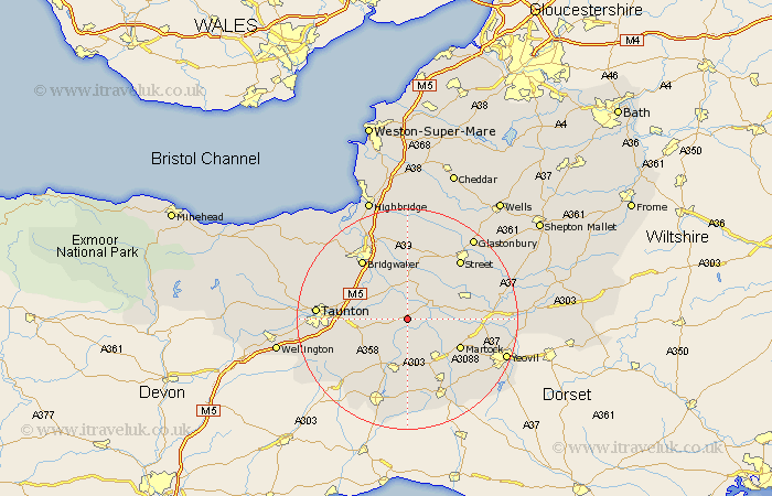
Somerset Map Showing Location of Curry Rivel
Population: 1865
Area Size (ha): 59
District: South Somerset
Easting: 338045 Northing: 124578
Latitude: 51.02 Longitude: -2.88
 = Curry Rivel
Area Size (ha): 59
District: South Somerset
Easting: 338045 Northing: 124578
Latitude: 51.02 Longitude: -2.88
= Curry Rivel
This Curry Rivel map below is supplied by Google. Use the tools in the top left corner to zoom into street level or zoom out for a road map, you may also need to zoom in to see Curry Rivel on the map. Click and drag the map to move around. If the map fails to load try and refresh your browser or zoom in or out (+ or -).
Update - it seems Google no longer allow people to use their maps for free! This Curry Rivel map sometimes loads and sometimes gives a error. I am working on a solution.
Closest 30 Towns or Cities to Curry Rivel (Population over 500)
Fivehead 2.98km Stoke St. Gregory 3.95km Stoke St Gregory 3.95km Stoke Saint Gregory 3.95km Langport 3.95km North Curry 5.83km Kingsbury Episcopi 6.91km Kingsbury 6.91km High Ham 7.25km Othery 7.41km Ilton 7.78km Long Sutton 8.16km Hatch Beauchamp 8.97km Creech Saint Michael 9.33km Creech St. Michael 9.33km Creech St Michael 9.33km Middlezoy 9.34km South Petherton 9.44km Ilminster 9.56km Somerton 10.03km Martock 10.86km Broadway 10.96km Weston Zoyland 11.66km West Monkton 12.23km Tintinhull 12.92km North Petherton 13.14km Shapwick 13.43km Bridgewater 13.79km Bridgwater 13.79km Walton 13.79km