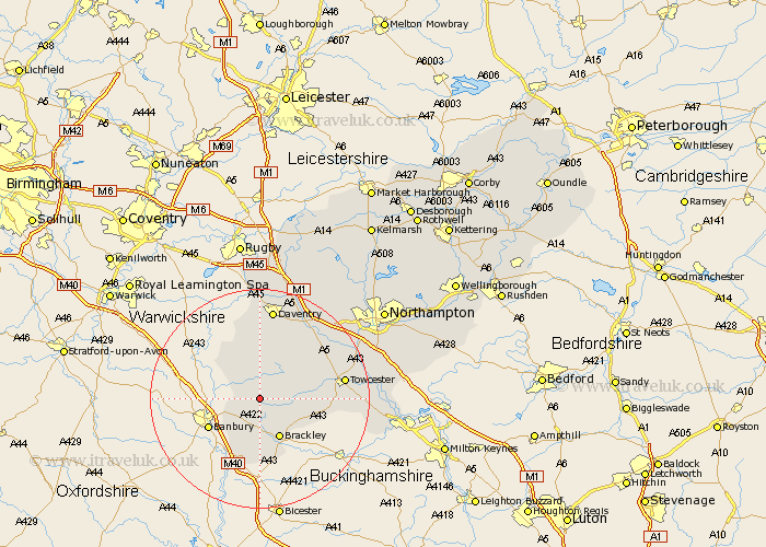
Northamptonshire Map Showing Location of Culworth
Population: 488
District: South Northamptonshire
Easting: 454792 Northing: 244976
Latitude: 52.1 Longitude: -1.2
 = Culworth
District: South Northamptonshire
Easting: 454792 Northing: 244976
Latitude: 52.1 Longitude: -1.2
= Culworth
This Culworth map below is supplied by Google. Use the tools in the top left corner to zoom into street level or zoom out for a road map, you may also need to zoom in to see Culworth on the map. Click and drag the map to move around. If the map fails to load try and refresh your browser or zoom in or out (+ or -).
Update - it seems Google no longer allow people to use their maps for free! This Culworth map sometimes loads and sometimes gives a error. I am working on a solution.
Closest 30 Towns or Cities to Culworth (Population over 500)
Greatworth 3.87km Chipping Warden 4.92km Helmdon 4.92km Chalcombe 5.99km Chacombe 5.99km Byfield 7.76km Brackley 8.17km Syresham 8.79km Upper Boddington 9.35km Boddington 9.35km Kings Sutton 10.32km Silverstone 12.66km Croughton 12.98km Badby 13.03km Aynho 13.42km Pattishall 14.55km Whittlebury 14.92km Towcester 15.25km Weedon 15.85km Weedon Beck 15.85km Bugbrooke 16.74km Daventry 16.83km Gayton 17.57km Flore 18.01km Paulerspury 18.31km Blisworth 19.65km Braunston 20.38km Kislingbury 20.54km Welton 20.67km Harpole 20.93km