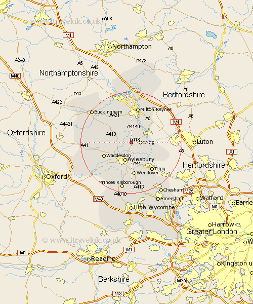
Buckinghamshire Map Showing Location of Cublington
Population: 338
District: Aylesbury Vale
Easting: 484879 Northing: 221294
Latitude: 51.88 Longitude: -0.77
 = Cublington
District: Aylesbury Vale
Easting: 484879 Northing: 221294
Latitude: 51.88 Longitude: -0.77
= Cublington
This Cublington map below is supplied by Google. Use the tools in the top left corner to zoom into street level or zoom out for a road map, you may also need to zoom in to see Cublington on the map. Click and drag the map to move around. If the map fails to load try and refresh your browser or zoom in or out (+ or -).
Update - it seems Google no longer allow people to use their maps for free! This Cublington map sometimes loads and sometimes gives a error. I am working on a solution.
Closest 30 Towns or Cities to Cublington (Population over 500)
Wing 3.43km Stewkley 3.88km Whitchurch 4.58km Whitechurch 4.58km Mursley 6.53km Soulbury 6.54km North Marston 6.86km Aylesbury 7.75km Stoke Hammond 8.17km Cheddington 8.84km Newton Longville 9.27km Slapton 9.34km Great Brickhill 9.36km Aston Clinton 9.88km Buckland 9.88km Marsworth 10.1km Winslow 10.1km Quainton 10.46km Stone 10.89km Stoke Mandeville 11.18km Weston Turville 11.18km Bletchley 11.35km Halton 11.35km Great Horwood 11.53km Ivinghoe 11.71km Waddesdon 11.71km Pitstone 12.69km Shenley Brook End 12.98km Wendover 13.02km Bow Brickhill 13.06km