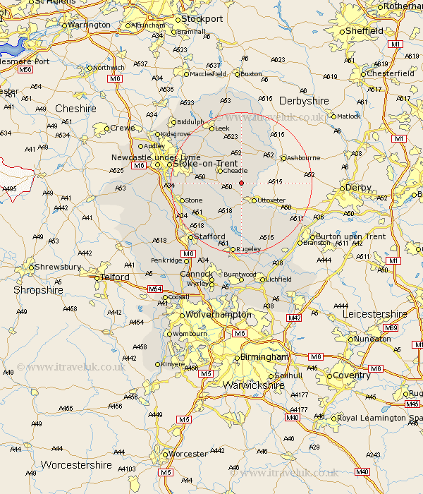
Staffordshire Map Showing Location of Croxden
Population: 249
District: East Staffordshire
Easting: 406718 Northing: 339219
Latitude: 52.95 Longitude: -1.9
 = Croxden
District: East Staffordshire
Easting: 406718 Northing: 339219
Latitude: 52.95 Longitude: -1.9
= Croxden
This Croxden map below is supplied by Google. Use the tools in the top left corner to zoom into street level or zoom out for a road map, you may also need to zoom in to see Croxden on the map. Click and drag the map to move around. If the map fails to load try and refresh your browser or zoom in or out (+ or -).
Update - it seems Google no longer allow people to use their maps for free! This Croxden map sometimes loads and sometimes gives a error. I am working on a solution.
Closest 30 Towns or Cities to Croxden (Population over 500)
Alton 2.17km Denstone 3.83km Denston 3.83km Checkley 3.83km Rocester 4.47km Oakamoor 5.67km Church Leigh 5.8km Leigh 5.8km Uttoxeter 6.49km Cheadle 6.7km Draycott in the Moors 9.12km Draycott 9.12km Kingsley 9.28km Waterhouses 9.53km Ipstones 10.28km Mayfield 10.52km Fulford 11.17km Marchington 11.44km Caverswall 11.76km Hilderstone 12.83km Cheddleton 14.26km Abbots Bromley 14.87km Weston 15.15km Weston upon Trent 15.15km Stone 16.6km Hanbury 17.13km Barlaston 17.87km Hatton 18.13km Tutbury 18.3km Leek 18.41km