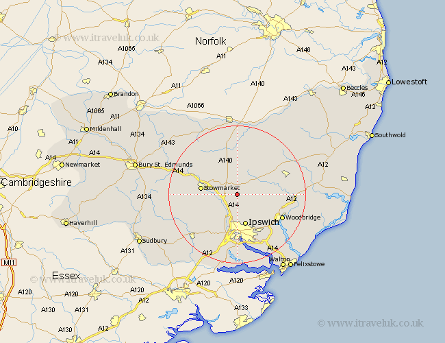
Suffolk Map Showing Location of Crowfield
Population: 329
District: Mid Suffolk
Easting: 614257 Northing: 256722
Latitude: 52.17 Longitude: 1.13
 = Crowfield
District: Mid Suffolk
Easting: 614257 Northing: 256722
Latitude: 52.17 Longitude: 1.13
= Crowfield
This Crowfield map below is supplied by Google. Use the tools in the top left corner to zoom into street level or zoom out for a road map, you may also need to zoom in to see Crowfield on the map. Click and drag the map to move around. If the map fails to load try and refresh your browser or zoom in or out (+ or -).
Update - it seems Google no longer allow people to use their maps for free! This Crowfield map sometimes loads and sometimes gives a error. I am working on a solution.
Closest 30 Towns or Cities to Crowfield (Population over 500)
Coddenham 3.88km Henley 5.68km Debenham 6.52km Otley 7.07km Great Blakenham 7.76km Witnesham 8.16km Wirnesham 8.16km Claydon 9.34km Somersham 9.35km Ipswich 9.55km Old Newton 9.7km Mendlesham 10.32km Stowmarket 10.39km Grundisburgh 10.88km Ringshall 10.89km Bramford 11.35km Haughley 11.64km Great Bricett 11.65km Thorndon 12.96km Sprughton 13.17km Sproughton 13.17km Great Finborough 13.64km Finborough 13.64km Bacton 13.67km Worlingworth 13.67km Hintlesham 14.17km Woodbridge 14.55km Melton 14.55km Martlesham 14.68km Framlingham 14.72km