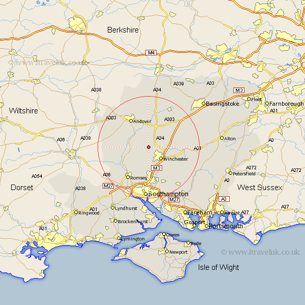
Hampshire Map Showing Location of Crawley
Population: 399
District: Winchester
Easting: 443174 Northing: 133650
Latitude: 51.1 Longitude: -1.38
 = Crawley
District: Winchester
Easting: 443174 Northing: 133650
Latitude: 51.1 Longitude: -1.38
= Crawley
This Crawley map below is supplied by Google. Use the tools in the top left corner to zoom into street level or zoom out for a road map, you may also need to zoom in to see Crawley on the map. Click and drag the map to move around. If the map fails to load try and refresh your browser or zoom in or out (+ or -).
Update - it seems Google no longer allow people to use their maps for free! This Crawley map sometimes loads and sometimes gives a error. I am working on a solution.
Closest 30 Towns or Cities to Crawley (Population over 500)
Sparsholt 3.7km Kings Worthy 6.11km Chilbolton 6.56km Winchester 6.7km Stockbridge 6.98km Wonston 7.25km Barton Stacey 7.51km Kings Somborne 7.91km Micheldever 8.94km Longparish 9.34km Hursley 9.34km Compton 9.9km Clatford 10.18km Lower Clatford 10.18km Goodworth Clatford 10.18km Twyford 10.37km Michlemersh 11.02km Michelmersh 11.02km Otterbourne 11.36km Upper Clatford 11.6km Broughton 11.79km Nether Wallop 12.93km Andover 13.13km Abbots Ann 13.13km Abbotts Ann 13.13km Whitchurch 13.44km Owslebury 13.79km Eastleigh 15km Bishopstoke 15.23km New Alresford 15.24km