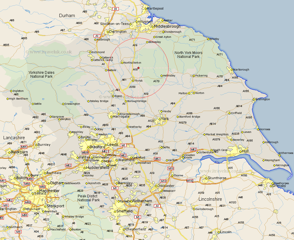
Yorkshire Map Showing Location of Cowesby
Population: 68
District: Hambleton
Easting: 446634 Northing: 489630
Latitude: 54.3 Longitude: -1.28
 = Cowesby
District: Hambleton
Easting: 446634 Northing: 489630
Latitude: 54.3 Longitude: -1.28
= Cowesby
This Cowesby map below is supplied by Google. Use the tools in the top left corner to zoom into street level or zoom out for a road map, you may also need to zoom in to see Cowesby on the map. Click and drag the map to move around. If the map fails to load try and refresh your browser or zoom in or out (+ or -).
Update - it seems Google no longer allow people to use their maps for free! This Cowesby map sometimes loads and sometimes gives a error. I am working on a solution.
Closest 30 Towns or Cities to Cowesby (Population over 500)
Osmotherley 7.5km Thirsk 9.82km Brompton 10.28km Northallerton 10.41km Whorlton 13.15km Topcliffe 14.51km Helmsley 15.13km Ampleforth 15.52km Great Broughton 18.31km Middleton 18.57km Middleton upon Leven 18.57km Raskelf 18.66km Dishforth 18.8km Ingleby 18.99km Seamer 19.03km Stokesley 19.3km Bedale 19.56km North Cowton 20.55km Cowton 20.76km East Cowton 20.76km Nawton 20.85km Easingwold 21.09km Tanfield 21.51km West Tanfield 21.51km Crakehall 21.63km Scorton 22.52km Kirby Moorside 23.02km Kirkby Moorside 23.02km Catterick 23.87km Great Ayton 24.27km