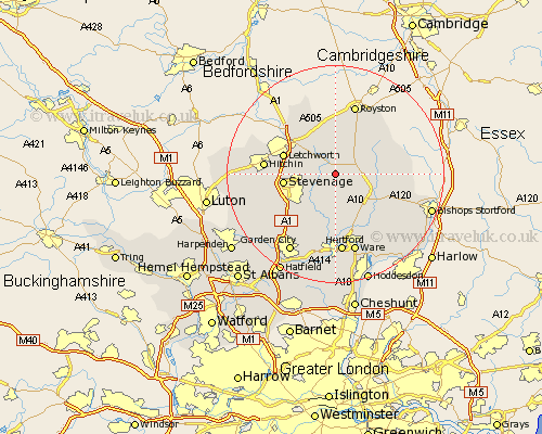
Hertfordshire Map Showing Location of Cottered
Population: 634
District: East Hertfordshire
Easting: 531757 Northing: 227871
Latitude: 51.93 Longitude: -0.08
 = Cottered
District: East Hertfordshire
Easting: 531757 Northing: 227871
Latitude: 51.93 Longitude: -0.08
= Cottered
This Cottered map below is supplied by Google. Use the tools in the top left corner to zoom into street level or zoom out for a road map, you may also need to zoom in to see Cottered on the map. Click and drag the map to move around. If the map fails to load try and refresh your browser or zoom in or out (+ or -).
Update - it seems Google no longer allow people to use their maps for free! This Cottered map sometimes loads and sometimes gives a error. I am working on a solution.
Closest 30 Towns or Cities to Cottered (Population over 500)
Walkern 3.89km Buntingford 4.93km Benington 5.68km Bennington 5.68km Weston 6.01km Aston 7.2km Little Munden 7.75km Braughing 7.79km Graveley 8km Hormead 8.21km Baldock 8.82km Wymondley 9.14km Great Wymondley 9.14km Stevenage 9.33km Watton 9.33km Watton at Stone 9.33km Therfield 9.55km Standon 9.74km Letchworth 9.86km Barkway 10.1km Datchworth 10.33km Stapleford 11.18km Knebworth 11.53km Albury 12.02km Ashwell 12.02km Thundridge 12.02km Hitchin 12.7km Little Hadham 12.71km Ickleford 13.1km Harmer Green 13.4km