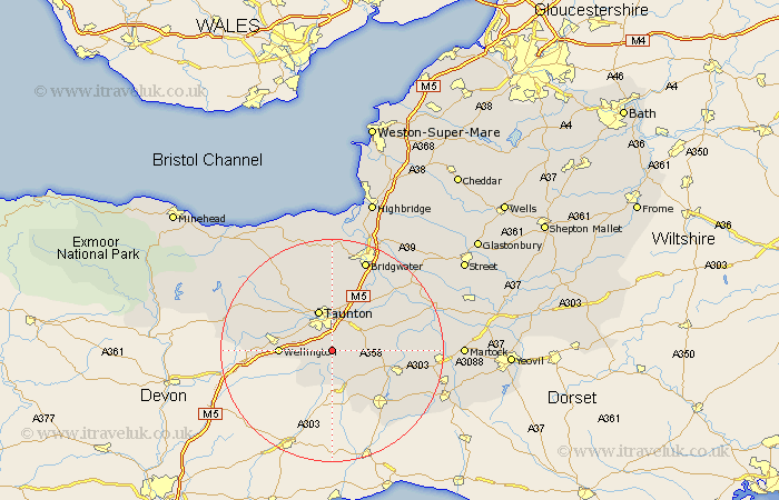
Somerset Map Showing Location of Corfe
Population: 271
District: Taunton Deane
Easting: 323936 Northing: 119205
Latitude: 50.97 Longitude: -3.08
 = Corfe
District: Taunton Deane
Easting: 323936 Northing: 119205
Latitude: 50.97 Longitude: -3.08
= Corfe
This Corfe map below is supplied by Google. Use the tools in the top left corner to zoom into street level or zoom out for a road map, you may also need to zoom in to see Corfe on the map. Click and drag the map to move around. If the map fails to load try and refresh your browser or zoom in or out (+ or -).
Update - it seems Google no longer allow people to use their maps for free! This Corfe map sometimes loads and sometimes gives a error. I am working on a solution.
Closest 30 Towns or Cities to Corfe (Population over 500)
Pitminster 2.33km Trull 4.38km Hatch Beauchamp 6.12km West Buckland 7km Creech Saint Michael 7.26km Creech St Michael 7.26km Creech St. Michael 7.26km Taunton 7.77km Norton Fitzwarren 8.75km Broadway 8.98km Wellington 9.34km Combe St Nicholas 9.44km Combe St. Nicholas 9.44km Combe Saint Nicholas 9.44km West Monkton 9.55km Oake 9.88km North Curry 9.88km Kingston 11.36km Ilton 11.82km Fivehead 12.24km Ilminster 12.25km Stoke St Gregory 12.85km Stoke St. Gregory 12.85km Stoke Saint Gregory 12.85km Milverton 12.92km Bishops Lydeard 13.14km Chard 13.8km Curry Rivel 15.06km North Petherton 15.54km Durleigh 16.84km