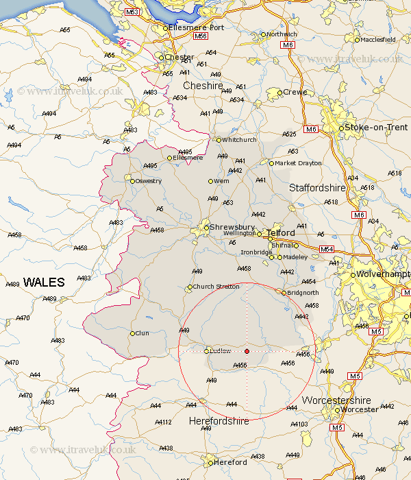
Shropshire Map Showing Location of Coreley
Population: 362
District: South Shropshire
Easting: 361420 Northing: 274487
Latitude: 52.37 Longitude: -2.57
 = Coreley
District: South Shropshire
Easting: 361420 Northing: 274487
Latitude: 52.37 Longitude: -2.57
= Coreley
This Coreley map below is supplied by Google. Use the tools in the top left corner to zoom into street level or zoom out for a road map, you may also need to zoom in to see Coreley on the map. Click and drag the map to move around. If the map fails to load try and refresh your browser or zoom in or out (+ or -).
Update - it seems Google no longer allow people to use their maps for free! This Coreley map sometimes loads and sometimes gives a error. I am working on a solution.
Closest 30 Towns or Cities to Coreley (Population over 500)
Cleobury Mortimer 5.95km Bitterley 6.76km Caynham 7.04km Ludlow 11.32km Kinlet 11.6km Ditton Priors 14.82km Diddlebury 15.07km Highley 15.51km Alveley 17.37km Rushbury 19.53km Craven Arms 19.55km Bridgnorth 21.13km Wistanstow 22.2km Worfield 24.48km Church Stretton 25.8km Claverley 25.88km Much Wenlock 25.97km Bucknell 26.03km Barrow Bridge 26.81km Barrow 26.81km North Lydbury 28.28km Lydbury North 28.28km Broseley 28.37km Cressage 29.84km Ironbridge 30.41km Madeley 30.99km Clun 32.15km Berrington 32.77km Condover 33.86km Dawley 34.04km