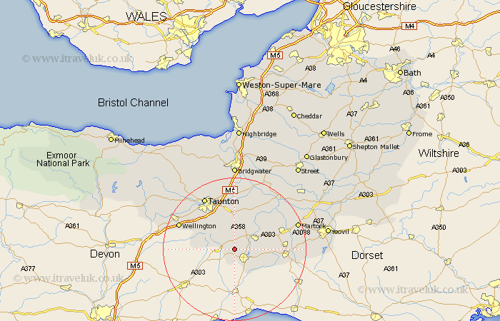
Somerset Map Showing Location of Combe St Nicholas
Population: 1317
District: South Somerset
Easting: 329687 Northing: 111706
Latitude: 50.9 Longitude: -3
 = Combe St Nicholas
District: South Somerset
Easting: 329687 Northing: 111706
Latitude: 50.9 Longitude: -3
= Combe St Nicholas
This Combe St Nicholas map below is supplied by Google. Use the tools in the top left corner to zoom into street level or zoom out for a road map, you may also need to zoom in to see Combe St Nicholas on the map. Click and drag the map to move around. If the map fails to load try and refresh your browser or zoom in or out (+ or -).
Update - it seems Google no longer allow people to use their maps for free! This Combe St Nicholas map sometimes loads and sometimes gives a error. I am working on a solution.
Closest 30 Towns or Cities to Combe St Nicholas (Population over 500)
Chard 4.38km Broadway 4.38km Ilminster 6.92km Ilton 8.06km Winsham 8.95km Hatch Beauchamp 9.26km Pitminster 11.04km Fivehead 12.56km Creech Saint Michael 13.03km Creech St. Michael 13.03km Creech St Michael 13.03km North Curry 13.18km Trull 13.8km Crewkerne 14.15km Misterton 14.51km West Buckland 14.84km South Petherton 15.08km Curry Rivel 15.34km Stoke St. Gregory 15.54km Stoke St Gregory 15.54km Stoke Saint Gregory 15.54km Kingsbury 16.8km Kingsbury Episcopi 16.8km Wellington 16.9km Taunton 16.93km West Monkton 17.04km Haselbury Plucknett 17.53km West Chinnock 17.63km Norton Fitzwarren 18.17km Langport 18.87km