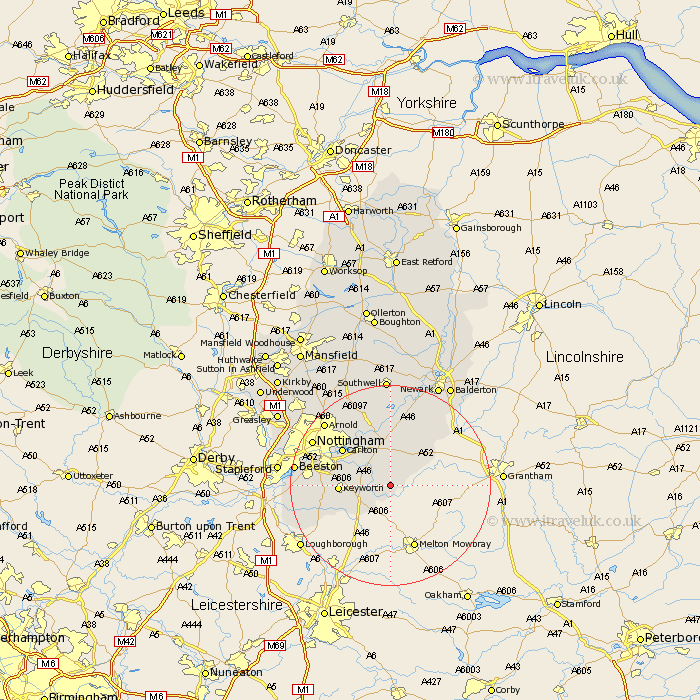
Nottinghamshire Map Showing Location of Colston Bassett
Population: 237
District: Rushcliffe
Easting: 470647 Northing: 332311
Latitude: 52.88 Longitude: -0.95
 = Colston Bassett
District: Rushcliffe
Easting: 470647 Northing: 332311
Latitude: 52.88 Longitude: -0.95
= Colston Bassett
This Colston Bassett map below is supplied by Google. Use the tools in the top left corner to zoom into street level or zoom out for a road map, you may also need to zoom in to see Colston Bassett on the map. Click and drag the map to move around. If the map fails to load try and refresh your browser or zoom in or out (+ or -).
Update - it seems Google no longer allow people to use their maps for free! This Colston Bassett map sometimes loads and sometimes gives a error. I am working on a solution.
Closest 30 Towns or Cities to Colston Bassett (Population over 500)
Cropwell Bishop 2.91km Barnstone 3.83km Kinoulton 4.33km Cropwell 4.34km Cropwell Butler 4.34km Bingham 5.56km Cotgrave 5.89km Aslockton 7.13km Aslocton 7.13km Radcliffe-on-Trent 7.88km Radcliffe 7.88km Radcliffe on Trent 7.88km East Bridgford 9.27km Tollerton 9.68km Shelford 10.29km Flintham 11.61km Colwick 11.62km Carlton 11.62km West Bridgeford 11.78km West Bridgford 11.78km Burton Joyce 12.45km Bunny 12.85km Ruddington 13.42km Lambley 13.59km Costock 14.37km Elston 15.85km East Leake 16.33km Bleasby 16.72km Woodborough 16.77km Gotham 17.18km