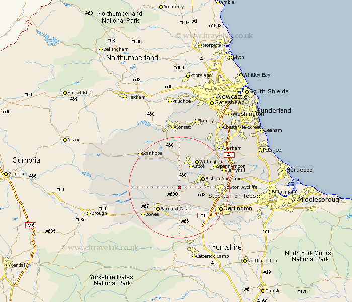
Durham Map Showing Location of Cockfield
Population: 1514
Area Size (ha): 34
District: Teesdale
Easting: 412914 Northing: 524647
Latitude: 54.62 Longitude: -1.8
 = Cockfield
Area Size (ha): 34
District: Teesdale
Easting: 412914 Northing: 524647
Latitude: 54.62 Longitude: -1.8
= Cockfield
This Cockfield map below is supplied by Google. Use the tools in the top left corner to zoom into street level or zoom out for a road map, you may also need to zoom in to see Cockfield on the map. Click and drag the map to move around. If the map fails to load try and refresh your browser or zoom in or out (+ or -).
Update - it seems Google no longer allow people to use their maps for free! This Cockfield map sometimes loads and sometimes gives a error. I am working on a solution.
Closest 30 Towns or Cities to Cockfield (Population over 500)
Evenwood 2.15km West Auckland 4.67km Etherley 4.91km High Etherley 4.91km Staindrop 5.56km Gainford 8.57km Bishop Auckland 9.35km Shildon 9.83km Crook 10.21km Coundon 11.14km Barnard Castle 11.94km Startforth 11.94km Wolsingham 12.34km Willington 12.85km Tow Law 13.01km Cotherstone 13.05km Newton Aycliffe 15.02km Spennymoor 15.81km Darlington 17.67km Ferryhill 17.71km Middleton in Teesdale 18.24km Cornsay 18.65km Brandon 18.94km Esh 19.61km Stanhope 20.34km Cornforth 20.44km West Cornforth 20.44km Ushaw Moor 20.88km Bishop Middleham 21.68km Langley Park 22.11km