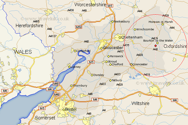
Gloucestershire Map Showing Location of Clapton
Population: 123
District: Cotswold
Easting: 416070 Northing: 216897
Latitude: 51.85 Longitude: -1.77
 = Clapton
District: Cotswold
Easting: 416070 Northing: 216897
Latitude: 51.85 Longitude: -1.77
= Clapton
This Clapton map below is supplied by Google. Use the tools in the top left corner to zoom into street level or zoom out for a road map, you may also need to zoom in to see Clapton on the map. Click and drag the map to move around. If the map fails to load try and refresh your browser or zoom in or out (+ or -).
Update - it seems Google no longer allow people to use their maps for free! This Clapton map sometimes loads and sometimes gives a error. I am working on a solution.
Closest 30 Towns or Cities to Clapton (Population over 500)
Bourton-on-the-Water 2.18km Bourton on the Water 2.18km Northleach 3.9km Stow-on-the-Wold 9.54km Stow on the Wold 9.54km Bledington 9.88km Bibury 11.64km Chedworth 11.71km Andoversford 12.73km Withington 12.73km Quenington 14.87km Moreton-in-Marsh 15.51km Moreton in the Marsh 15.51km Moreton in Marsh 15.51km North Cerney 16.58km Fairford 16.72km Winchcombe 16.79km Winchcomb 16.79km Lechlade 17.3km Ampney St. Peter 18.51km Ampney 18.51km Ampney Saint Peter 18.51km Ampney St Peter 18.51km Blockley 18.57km Cicester 19.76km Cirencester 19.76km Kempsford 20.38km Chipping Campden 20.41km Charlton Kings 20.69km Southam 21.54km