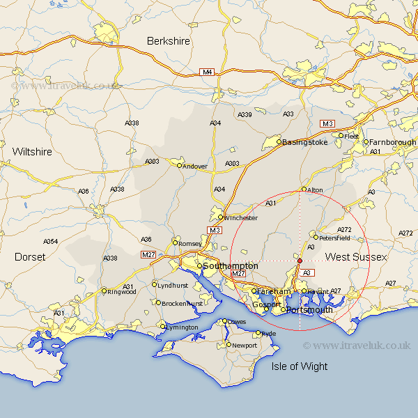
Hampshire Map Showing Location of Clanfield
Population: 4507
District: East Hampshire
Easting: 470262 Northing: 115409
Latitude: 50.93 Longitude: -1
 = Clanfield
District: East Hampshire
Easting: 470262 Northing: 115409
Latitude: 50.93 Longitude: -1
= Clanfield
This Clanfield map below is supplied by Google. Use the tools in the top left corner to zoom into street level or zoom out for a road map, you may also need to zoom in to see Clanfield on the map. Click and drag the map to move around. If the map fails to load try and refresh your browser or zoom in or out (+ or -).
Update - it seems Google no longer allow people to use their maps for free! This Clanfield map sometimes loads and sometimes gives a error. I am working on a solution.
Closest 30 Towns or Cities to Clanfield (Population over 500)
Horndean 2.18km Hambledon 5.02km Buriton 5.11km East Meon 6.03km Rowlands Castle 6.57km Waterlooville 7.5km Waterloo 7.5km Petersfield 8.76km Froxfield 9.27km Havant 9.34km Soberton 9.34km Droxford 9.52km Corhampton 10.05km Emsworth 10.38km Steep 10.38km West Meon 10.96km Southwick 11.04km Swanmore 11.68km Wickham 12.26km Shedfield 12.98km Shidfield 12.98km Liss 13.14km Bramdean 13.8km Portchester 13.81km Porchester 13.81km Waltham Chase 14.14km Greatham 14.74km Bishops Waltham 15.29km Bishop's Waltham 15.29km Fareham 15.85km