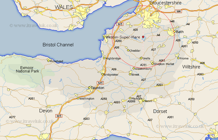
Somerset Map Showing Location of Chew Stoke
Population: 905
Easting: 355899 Northing: 161459
Latitude: 51.35 Longitude: -2.63
 = Chew Stoke
Easting: 355899 Northing: 161459
Latitude: 51.35 Longitude: -2.63
= Chew Stoke
This Chew Stoke map below is supplied by Google. Use the tools in the top left corner to zoom into street level or zoom out for a road map, you may also need to zoom in to see Chew Stoke on the map. Click and drag the map to move around. If the map fails to load try and refresh your browser or zoom in or out (+ or -).
Update - it seems Google no longer allow people to use their maps for free! This Chew Stoke map sometimes loads and sometimes gives a error. I am working on a solution.
Closest 30 Towns or Cities to Chew Stoke (Population over 500)
Chew Magna 2.19km Great Chew 2.19km Winford 3.88km Dundry 5.56km East Harptree 5.56km Compton Martin 5.68km Blagdon 6.08km Publow 7.19km Clutton 7.19km Temple Cloud 7.23km Whitchurch 7.23km Flax Bourton 8.74km Bourton 8.74km Compton Dando 8.9km Long Ashton 9.33km Wrington 9.44km Farmboro 9.45km Farmborough 9.45km Chewton Mendip 9.89km Farrington Gurney 10.16km Keynsham 10.8km Paulton 10.8km Timsbury 11.06km Congresbury 11.72km Churchill 11.73km Shipham 12.85km Nailsea 13.09km Stratton-on-the-Fosse 13.1km Chilcompton 13.1km Stratton on the Fosse 13.1km