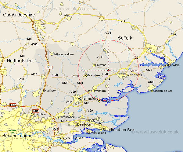
Essex Map Showing Location of Chappel
Population: 546
District: Colchester
Easting: 590249 Northing: 227906
Latitude: 51.92 Longitude: 0.77
 = Chappel
District: Colchester
Easting: 590249 Northing: 227906
Latitude: 51.92 Longitude: 0.77
= Chappel
This Chappel map below is supplied by Google. Use the tools in the top left corner to zoom into street level or zoom out for a road map, you may also need to zoom in to see Chappel on the map. Click and drag the map to move around. If the map fails to load try and refresh your browser or zoom in or out (+ or -).
Update - it seems Google no longer allow people to use their maps for free! This Chappel map sometimes loads and sometimes gives a error. I am working on a solution.
Closest 30 Towns or Cities to Chappel (Population over 500)
Wakes Colne 1.14km Great Tey 2.18km Fordham 2.29km West Bergholt 4.57km Earls Colne 4.93km Marks Tey 5.68km Great Horkesley 7.1km Horkesley 7.1km Copford 7.76km Coggeshall 7.98km Feering 8.17km Halstead 9.86km Colchester 9.87km Birch 9.89km Kelvedon 10.34km Layer de la Haye 10.9km Boxted 10.93km Stisted 10.94km Rivenhall 11.54km Bradwell 11.7km Bulmer 12.5km Gosfield 12.71km Tiptree 13.18km Castle Hedingham 13.61km Cressing 13.63km Sible Hedingham 13.74km Rayne 13.75km Great Totham 13.76km Totham 13.76km Braintree 14.22km