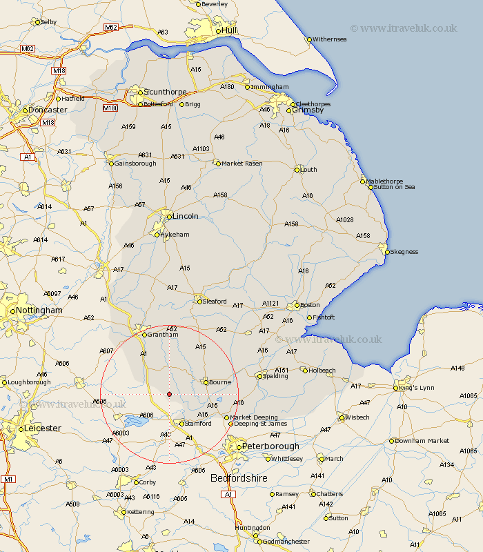
Lincolnshire Map Showing Location of Castle Bytham
Population: 744
District: South Kesteven
Easting: 499021 Northing: 316120
Latitude: 52.73 Longitude: -0.53
 = Castle Bytham
District: South Kesteven
Easting: 499021 Northing: 316120
Latitude: 52.73 Longitude: -0.53
= Castle Bytham
This Castle Bytham map below is supplied by Google. Use the tools in the top left corner to zoom into street level or zoom out for a road map, you may also need to zoom in to see Castle Bytham on the map. Click and drag the map to move around. If the map fails to load try and refresh your browser or zoom in or out (+ or -).
Update - it seems Google no longer allow people to use their maps for free! This Castle Bytham map sometimes loads and sometimes gives a error. I am working on a solution.
Closest 30 Towns or Cities to Castle Bytham (Population over 500)
South Witham 5.91km Corby 7.5km Colsterworth 9.3km Stamford 9.86km Bourne 10.76km Bourn 10.76km Thurlby 11.38km Uffington 12.15km Morton 12.52km Baston 12.89km Langfoft 13.97km Langtoft 13.97km Rippingale 14.55km Ropsley 16.72km Folkingham 17.33km Market Deeping 17.38km Harlaxton 17.94km Pointon 18.69km Deeping Saint James 19.23km Deeping St. James 19.23km Deeping St James 19.23km Grantham 19.72km Barrowby 21.1km Billingborough 21.42km Great Gonerby 22.27km Deeping St Nicholas 22.52km Deeping Saint Nicholas 22.52km Deeping St. Nicholas 22.52km Belton 22.69km Spalding 25.29km