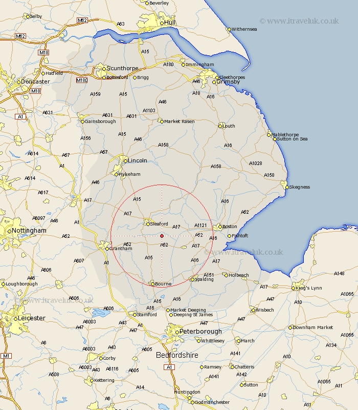
Lincolnshire Map Showing Location of Burton Pedwardine
Population: 96
District: North Kesteven
Easting: 511964 Northing: 340514
Latitude: 52.95 Longitude: -0.33
 = Burton Pedwardine
District: North Kesteven
Easting: 511964 Northing: 340514
Latitude: 52.95 Longitude: -0.33
= Burton Pedwardine
This Burton Pedwardine map below is supplied by Google. Use the tools in the top left corner to zoom into street level or zoom out for a road map, you may also need to zoom in to see Burton Pedwardine on the map. Click and drag the map to move around. If the map fails to load try and refresh your browser or zoom in or out (+ or -).
Update - it seems Google no longer allow people to use their maps for free! This Burton Pedwardine map sometimes loads and sometimes gives a error. I am working on a solution.
Closest 30 Towns or Cities to Burton Pedwardine (Population over 500)
Helpringham 2.9km Hale 3.35km Great Hale 3.35km Heckington 3.83km Sleaford 7.04km Billingborough 7.42km Heasingham 9.28km Leasingham 9.28km Buskington 9.85km Ruskington 9.85km Folkingham 10.28km Donington 10.53km Pointon 11.12km Bicker 11.77km Swineshead 12.42km Cranwell 12.86km Brauncewell 12.98km Ancaster 13.52km Ropsley 14.36km Quadring 14.52km Digby 14.99km Rippingale 14.99km Billinghay 15.2km Bloxholm 15.84km Bloxholme 15.84km Brothertoft 16.06km Gosberton 16.58km Scopwick 17.26km Sutterton 17.66km Belton 17.97km