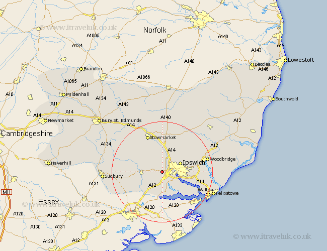
Suffolk Map Showing Location of Burstall
Population: 189
District: Babergh
Easting: 610249 Northing: 243553
Latitude: 52.05 Longitude: 1.07
 = Burstall
District: Babergh
Easting: 610249 Northing: 243553
Latitude: 52.05 Longitude: 1.07
= Burstall
This Burstall map below is supplied by Google. Use the tools in the top left corner to zoom into street level or zoom out for a road map, you may also need to zoom in to see Burstall on the map. Click and drag the map to move around. If the map fails to load try and refresh your browser or zoom in or out (+ or -).
Update - it seems Google no longer allow people to use their maps for free! This Burstall map sometimes loads and sometimes gives a error. I am working on a solution.
Closest 30 Towns or Cities to Burstall (Population over 500)
Hintlesham 1.14km Sproughton 2.28km Sprughton 2.28km Bramford 2.94km Claydon 5.04km Capel St Mary 5.56km Capel St. Mary 5.56km Capel 5.56km Capel Saint Mary 5.56km Somersham 5.67km Great Blakenham 6.01km Bentley 7.5km Ipswich 7.77km Layham 7.78km Hadleigh 7.98km Great Bricett 9.35km Henley 9.35km Wirnesham 9.72km Witnesham 9.72km Coddenham 9.87km East Bergholt 9.88km Holbrook 10.09km Ringshall 10.87km Stutton 10.88km Manningtree 11.12km Bildeston 11.66km Nacton 11.99km Chelmondiston 12.66km Bucklesham 12.68km Polstead 12.69km