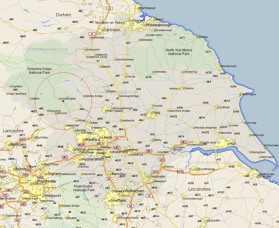
Yorkshire Map Showing Location of Burnsall
Population: 112
District: Craven
Easting: 403273 Northing: 461581
Latitude: 54.05 Longitude: -1.95
 = Burnsall
District: Craven
Easting: 403273 Northing: 461581
Latitude: 54.05 Longitude: -1.95
= Burnsall
This Burnsall map below is supplied by Google. Use the tools in the top left corner to zoom into street level or zoom out for a road map, you may also need to zoom in to see Burnsall on the map. Click and drag the map to move around. If the map fails to load try and refresh your browser or zoom in or out (+ or -).
Update - it seems Google no longer allow people to use their maps for free! This Burnsall map sometimes loads and sometimes gives a error. I am working on a solution.
Closest 30 Towns or Cities to Burnsall (Population over 500)
Grassington 2.86km Threshfield 4.35km Embsay 9.51km Skipton 10.24km Gargrave 12.29km Bewerley 12.52km Addingham 13.69km Carleton 14.53km Carlton 14.53km Dacre 15.23km Cononley 15.45km Darley 16.43km Silsden 16.71km Glusburn 17km Ilkley 17.2km Earby 18.4km Steeton 18.53km Bradley 18.57km Keighley 18.66km Sutton-in-Craven 18.66km Hellifield 18.94km Burley in Wharfedale 19.77km Burley 19.77km Long Preston 20.37km Giggleswick 20.67km Settle 20.75km Birstwith 21.84km Hampsthwaite 23.15km Menston 23.33km Kirkby Malzeard 23.47km