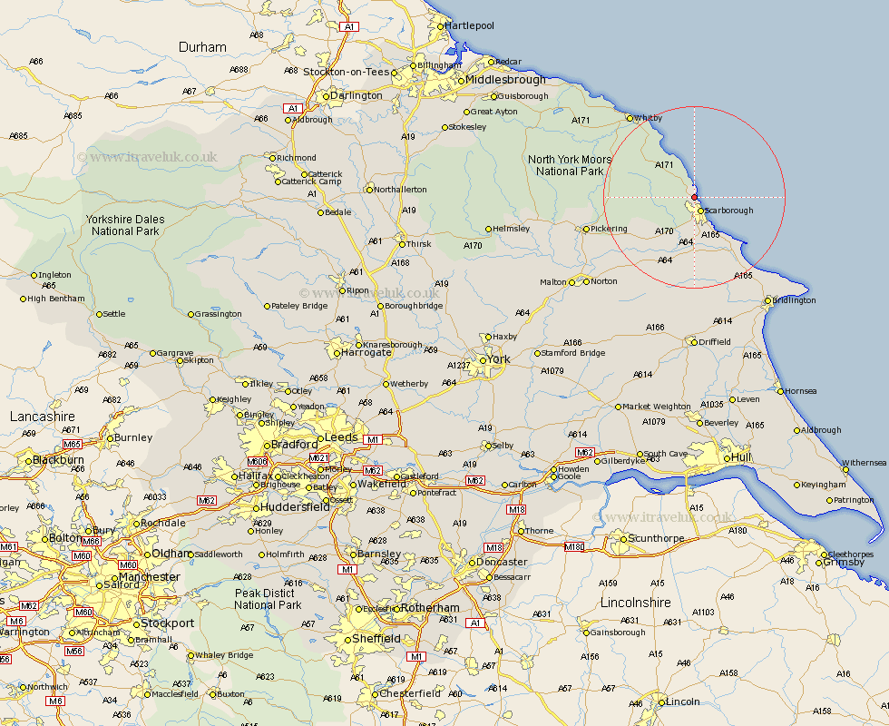
Yorkshire Map Showing Location of Burniston
Population: 2008
Area Size (ha): 83
District: Scarborough
Easting: 501899 Northing: 492383
Latitude: 54.32 Longitude: -0.43
 = Burniston
Area Size (ha): 83
District: Scarborough
Easting: 501899 Northing: 492383
Latitude: 54.32 Longitude: -0.43
= Burniston
This Burniston map below is supplied by Google. Use the tools in the top left corner to zoom into street level or zoom out for a road map, you may also need to zoom in to see Burniston on the map. Click and drag the map to move around. If the map fails to load try and refresh your browser or zoom in or out (+ or -).
Update - it seems Google no longer allow people to use their maps for free! This Burniston map sometimes loads and sometimes gives a error. I am working on a solution.
Closest 30 Towns or Cities to Burniston (Population over 500)
Cloughton 1.85km Scarborough 3.51km Scalby 3.71km Seamer 9.27km Eastfield 9.52km Cayton 10.23km Fylingdales 12.87km Brompton 13.46km Snainton 14.78km Willerby 14.87km Filey 15.11km Hawsker 17.15km Sherburn 17.54km Yedingham 17.61km Hunmanby 18.32km Thornton-le-Dale 20.6km Thornton Dale 20.6km Sleights 21.17km Whitby 22.81km Pickering 22.87km Great Driffield 24.1km Rillington 25.38km Bempton 26.76km Bridlington 28.68km Norton 29.5km Kilham 29.97km Flamborough 31.7km Malton 31.87km Hinderwell 32.33km Kirby Moorside 32.92km