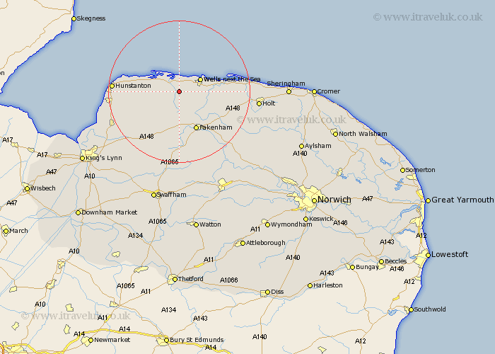
Norfolk Map Showing Location of Burnham Thorpe
Population: 168
District: King's Lynn and West Norfolk
Easting: 585920 Northing: 340940
Latitude: 52.93 Longitude: 0.77
 = Burnham Thorpe
District: King's Lynn and West Norfolk
Easting: 585920 Northing: 340940
Latitude: 52.93 Longitude: 0.77
= Burnham Thorpe
This Burnham Thorpe map below is supplied by Google. Use the tools in the top left corner to zoom into street level or zoom out for a road map, you may also need to zoom in to see Burnham Thorpe on the map. Click and drag the map to move around. If the map fails to load try and refresh your browser or zoom in or out (+ or -).
Update - it seems Google no longer allow people to use their maps for free! This Burnham Thorpe map sometimes loads and sometimes gives a error. I am working on a solution.
Closest 30 Towns or Cities to Burnham Thorpe (Population over 500)
Burnham Market 2.9km South Creake 5.56km Wells-on-Sea 6.71km Wells next the Sea 6.71km Wells-next-the-Sea 6.71km Wells 6.71km Wells on Sea 6.71km Brancaster 8.65km Walsingham 9.6km Little Walsingham 9.6km Syderstone 9.85km Sculthorpe 9.85km Docking 10.72km Tatterset 11.34km Tattersett 11.34km Fakenham 11.99km Little Snoring 12.88km Bircham 12.88km Great Bircham 12.88km East Rudham 13.39km Sedgeford 14.99km Colkirk 15.84km Blakeney 16.07km Ryburgh 16.41km Great Ryburgh 16.41km Hunstanton 17.97km Ingoldesthorpe 18.33km Ingoldisthorpe 18.33km Heacham 19.08km Snettisham 19.36km