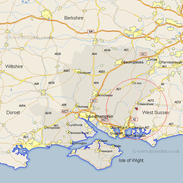
Hampshire Map Showing Location of Buriton
Population: 736
District: East Hampshire
Easting: 473722 Northing: 119172
Latitude: 50.97 Longitude: -0.95
 = Buriton
District: East Hampshire
Easting: 473722 Northing: 119172
Latitude: 50.97 Longitude: -0.95
= Buriton
This Buriton map below is supplied by Google. Use the tools in the top left corner to zoom into street level or zoom out for a road map, you may also need to zoom in to see Buriton on the map. Click and drag the map to move around. If the map fails to load try and refresh your browser or zoom in or out (+ or -).
Update - it seems Google no longer allow people to use their maps for free! This Buriton map sometimes loads and sometimes gives a error. I am working on a solution.
Closest 30 Towns or Cities to Buriton (Population over 500)
Petersfield 3.88km Clanfield 5.11km Steep 5.68km Horndean 6.03km East Meon 6.12km Froxfield 6.57km Liss 8.19km Rowlands Castle 9.27km Hambledon 9.89km Greatham 9.9km West Meon 10.86km Waterloo 12.06km Waterlooville 12.06km Corhampton 12.84km Droxford 12.97km Selborne 13.02km Emsworth 13.03km Havant 13.19km Soberton 13.37km Bramdean 13.81km Ropley 14.51km Farringdon 15km Faringdon 15km Upper Farringdon 15km Liphook 15.29km Swanmore 15.62km Southwick 16.13km Bramshot 16.68km Wickham 16.9km Shidfield 17.27km