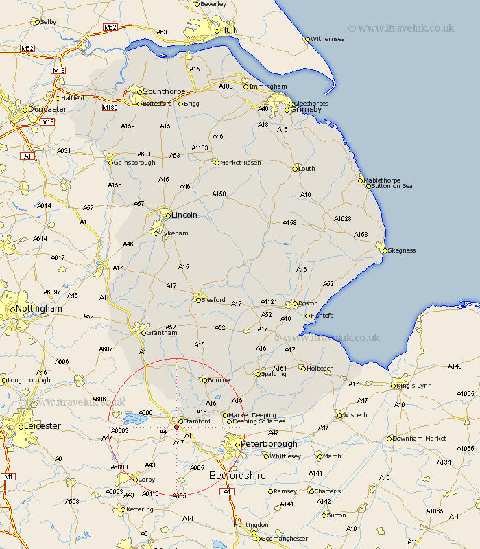
Lincolnshire Map Showing Location of Easton
Population: 100
District: South Kesteven
Easting: 501503 Northing: 305044
Latitude: 52.63 Longitude: -0.5
 = Easton
District: South Kesteven
Easting: 501503 Northing: 305044
Latitude: 52.63 Longitude: -0.5
= Easton
This Easton map below is supplied by Google. Use the tools in the top left corner to zoom into street level or zoom out for a road map, you may also need to zoom in to see Easton on the map. Click and drag the map to move around. If the map fails to load try and refresh your browser or zoom in or out (+ or -).
Update - it seems Google no longer allow people to use their maps for free! This Easton map sometimes loads and sometimes gives a error. I am working on a solution.
Closest 30 Towns or Cities to Easton (Population over 500)
Stamford 2.17km Uffington 5.92km Castle Bytham 11.34km Baston 12.54km Thurlby 12.92km Langfoft 13.47km Langtoft 13.47km Market Deeping 13.99km Deeping Saint James 14.74km Deeping St James 14.74km Deeping St. James 14.74km South Witham 15.17km Bourne 16.79km Bourn 16.79km Corby 18.57km Morton 18.95km Colsterworth 20.13km Deeping Saint Nicholas 22.25km Deeping St Nicholas 22.25km Deeping St. Nicholas 22.25km Rippingale 22.28km Crowland 23.9km Croyland 23.9km Leverington 25.01km Pointon 26.58km Folkingham 26.81km Ropsley 27.82km Spalding 27.97km Cowbit 28.13km Harlaxton 28.74km