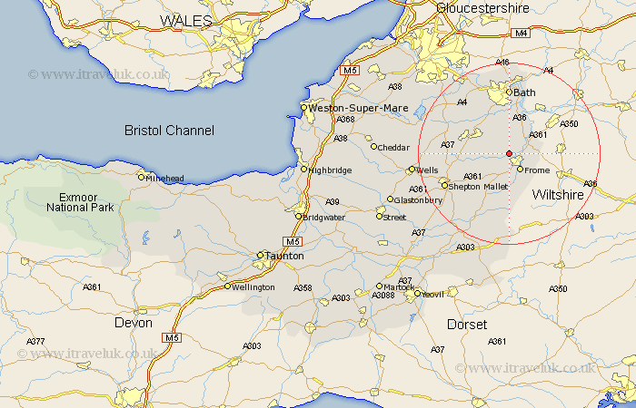
Somerset Map Showing Location of Buckland Denham
Population: 379
District: Mendip
Easting: 375575 Northing: 150207
Latitude: 51.25 Longitude: -2.35
 = Buckland Denham
District: Mendip
Easting: 375575 Northing: 150207
Latitude: 51.25 Longitude: -2.35
= Buckland Denham
This Buckland Denham map below is supplied by Google. Use the tools in the top left corner to zoom into street level or zoom out for a road map, you may also need to zoom in to see Buckland Denham on the map. Click and drag the map to move around. If the map fails to load try and refresh your browser or zoom in or out (+ or -).
Update - it seems Google no longer allow people to use their maps for free! This Buckland Denham map sometimes loads and sometimes gives a error. I am working on a solution.
Closest 30 Towns or Cities to Buckland Denham (Population over 500)
Mells 3.95km Frome 4.37km Beckington 5km Norton Saint Philip 5.68km Norton St. Philip 5.68km Norton St Philip 5.68km Rode 5.94km Road 5.94km Nunney 6.02km Kilmersden 6.09km Kilmersdon 6.09km Wellow 7.77km Coleford 7.87km Leigh-on-Mendip 7.89km Leigh on Mendip 7.89km Leigh upon Mendip 7.89km Leigh 7.89km Holcombe 9.47km Freshford 9.89km Camerton 10.17km Chilcompton 10.6km Stratton-on-the-Fosse 10.6km Stratton 10.6km Stratton on the Fosse 10.6km Paulton 11.82km Timsbury 11.87km Farrington Gurney 13.28km Farmboro 13.95km Farmborough 13.95km Bath 14.82km