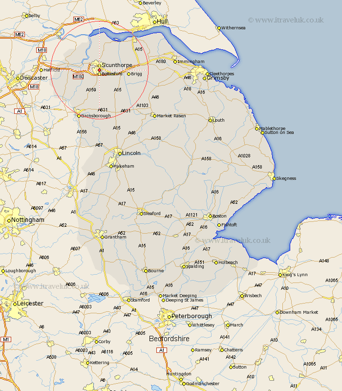
Lincolnshire Map Showing Location of Brumby
Easting: 489397 Northing: 408661
Latitude: 53.57 Longitude: -0.65
 = Brumby
Latitude: 53.57 Longitude: -0.65
= Brumby
This Brumby map below is supplied by Google. Use the tools in the top left corner to zoom into street level or zoom out for a road map, you may also need to zoom in to see Brumby on the map. Click and drag the map to move around. If the map fails to load try and refresh your browser or zoom in or out (+ or -).
Update - it seems Google no longer allow people to use their maps for free! This Brumby map sometimes loads and sometimes gives a error. I am working on a solution.
Closest 30 Towns or Cities to Brumby (Population over 500)
Scunthorpe 1.85km Bottesford 1.86km Messingham 3.71km Gunness 5.8km Gunhouse 5.8km Flixborough 5.98km Broughton 6.6km Burringham 6.6km Keadby 6.63km West Butterwick 6.86km Appleby 7.82km Scawby 8.55km Scotter 9.34km Burton upon Stather 9.52km Burton 9.52km Winterton 9.83km Hibaldstow 10.7km Scotton 11.12km Brigg 11.16km Belton 11.16km Kirton 11.6km Kirton in Lindsey 11.6km Crowle 11.61km Owston 12.06km Owston Ferry 12.06km Wrawby 12.11km Epworth 12.34km Winteringham 13.38km South Ferriby 14.88km Haxey 15.26km