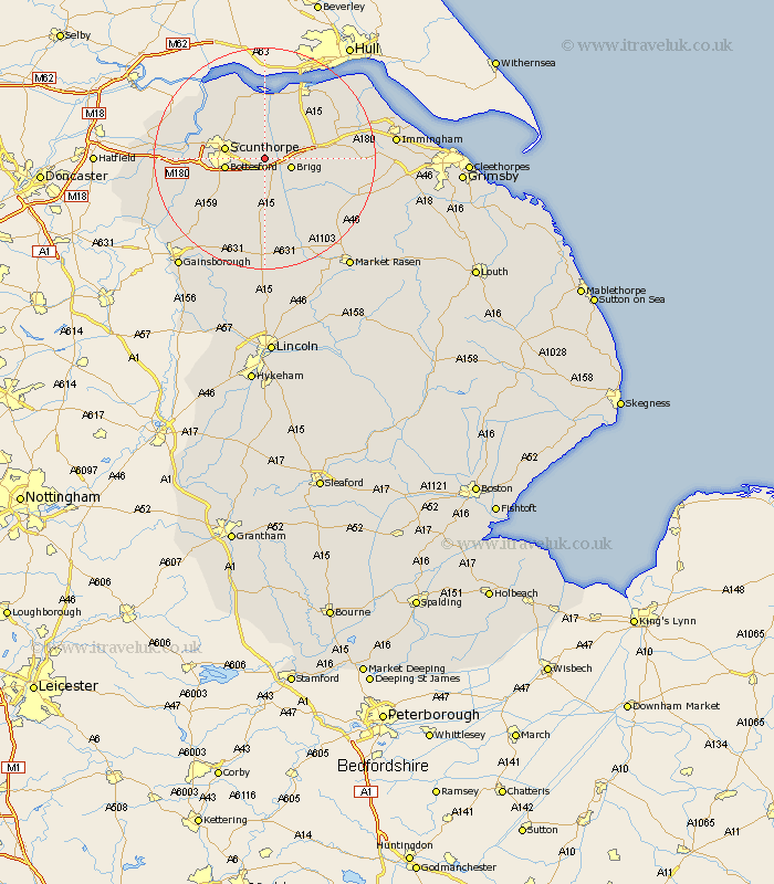
Lincolnshire Map Showing Location of Broughton
Population: 4362
Area Size (ha): 110
Easting: 496018 Northing: 408792
Latitude: 53.57 Longitude: -0.55
 = Broughton
Area Size (ha): 110
Easting: 496018 Northing: 408792
Latitude: 53.57 Longitude: -0.55
= Broughton
This Broughton map below is supplied by Google. Use the tools in the top left corner to zoom into street level or zoom out for a road map, you may also need to zoom in to see Broughton on the map. Click and drag the map to move around. If the map fails to load try and refresh your browser or zoom in or out (+ or -).
Update - it seems Google no longer allow people to use their maps for free! This Broughton map sometimes loads and sometimes gives a error. I am working on a solution.
Closest 30 Towns or Cities to Broughton (Population over 500)
Scawby 3.87km Brigg 4.78km Wrawby 5.5km Appleby 5.67km Scunthorpe 6.86km Bottesford 6.86km Hibaldstow 7.5km Messingham 7.58km Winterton 9.83km Barnetby le Wold 9.91km Barnetby 9.91km Flixborough 10.41km South Ferriby 11.6km Kirton in Lindsey 11.6km Kirton 11.6km Scotter 12.06km Gunness 12.24km Gunhouse 12.24km Keadby 12.66km Burton upon Stather 12.77km Burton 12.77km North Kelsey 12.79km Scotton 12.94km Waddingham 13.16km Burringham 13.21km West Butterwick 13.34km Winteringham 13.38km South Kelsey 13.53km Ulceby 15.34km Barrow upon Humber 17km