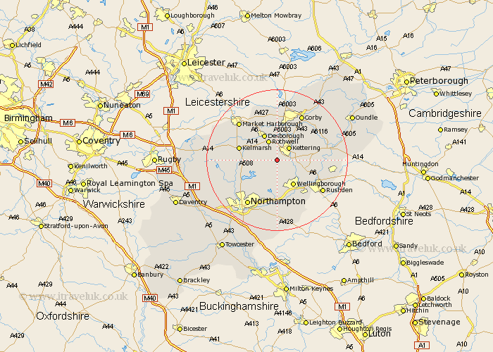
Northamptonshire Map Showing Location of Broughton
Population: 1977
Area Size (ha): 50
District: Kettering
Easting: 483965 Northing: 275052
Latitude: 52.37 Longitude: -0.77
 = Broughton
Area Size (ha): 50
District: Kettering
Easting: 483965 Northing: 275052
Latitude: 52.37 Longitude: -0.77
= Broughton
This Broughton map below is supplied by Google. Use the tools in the top left corner to zoom into street level or zoom out for a road map, you may also need to zoom in to see Broughton on the map. Click and drag the map to move around. If the map fails to load try and refresh your browser or zoom in or out (+ or -).
Update - it seems Google no longer allow people to use their maps for free! This Broughton map sometimes loads and sometimes gives a error. I am working on a solution.
Closest 30 Towns or Cities to Broughton (Population over 500)
Isham 4.89km Kettering 5.02km Walgrave 5.03km Rowell 6km Rothwell 6km Burton Latimer 7.04km Desborough 8.15km Wellingborough 8.69km Geddington 9.32km Sywell 9.34km Finedon 9.79km Overstone 9.88km Brixworth 10.63km Pitsford 10.86km Moulton 10.87km Wilby 11.63km Great Doddington 12.01km Doddington 12.01km Irthlingborough 12.61km Boughton 12.97km Cottingham 13.01km Earls Barton 13.03km Wilbarston 13.16km Great Billing 13.41km Billing 13.41km Woodford 13.58km Clipston 13.63km Spratton 13.64km Stanion 13.65km Irchester 14.35km