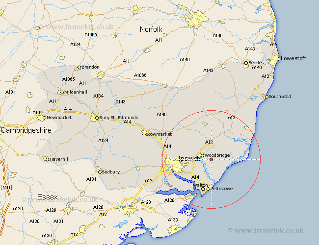
Suffolk Map Showing Location of Bromeswell
Population: 326
District: Suffolk Coastal
Easting: 630639 Northing: 248166
Latitude: 52.08 Longitude: 1.37
 = Bromeswell
District: Suffolk Coastal
Easting: 630639 Northing: 248166
Latitude: 52.08 Longitude: 1.37
= Bromeswell
This Bromeswell map below is supplied by Google. Use the tools in the top left corner to zoom into street level or zoom out for a road map, you may also need to zoom in to see Bromeswell on the map. Click and drag the map to move around. If the map fails to load try and refresh your browser or zoom in or out (+ or -).
Update - it seems Google no longer allow people to use their maps for free! This Bromeswell map sometimes loads and sometimes gives a error. I am working on a solution.
Closest 30 Towns or Cities to Bromeswell (Population over 500)
Sutton 2.17km Ufford 3.88km Melton 3.89km Woodbridge 3.89km Martlesham 4.56km Rendlesham 5.05km Hollesley 5.87km Martlesham Heath 5.99km Wickham Market 7.42km Tunstall 7.96km Grundisburgh 8.18km Bucklesham 9.72km Kirton 9.87km Kirkton 9.87km Orford 11.39km Otley 11.74km Nacton 11.75km Witnesham 12.66km Wirnesham 12.66km Felixstowe 13.02km Walton 13.35km Ipswich 13.67km Snape 14.37km Framlingham 15.01km Chelmondiston 15.13km Shotley 15.23km Henley 15.26km Claydon 17.08km Saxmundham 17.4km Aldeburgh 17.57km