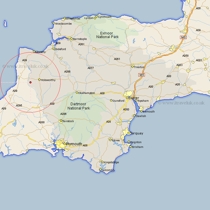
Devon Map Showing Location of Bridgerule
Population: 570
District: Torridge
Easting: 228547 Northing: 102933
Latitude: 50.8 Longitude: -4.43
 = Bridgerule
District: Torridge
Easting: 228547 Northing: 102933
Latitude: 50.8 Longitude: -4.43
= Bridgerule
This Bridgerule map below is supplied by Google. Use the tools in the top left corner to zoom into street level or zoom out for a road map, you may also need to zoom in to see Bridgerule on the map. Click and drag the map to move around. If the map fails to load try and refresh your browser or zoom in or out (+ or -).
Update - it seems Google no longer allow people to use their maps for free! This Bridgerule map sometimes loads and sometimes gives a error. I am working on a solution.
Closest 30 Towns or Cities to Bridgerule (Population over 500)
Pyworthy 2.34km Holsworthy 6.14km Bradworthy 11.66km Ashwater 12.9km Halwill 14.54km Saint Giles on the Heath 14.76km St Giles-on-the-Heath 14.76km St. Giles 14.76km St Giles 14.76km St Giles on the Heath 14.76km Saint Giles 14.76km St. Giles on the Heath 14.76km St. Giles-on-the-Heath 14.76km Saint Giles-on-the-Heath 14.76km Shebbear 16.2km Black Torrington 17.66km Broadwoodwidger 18.3km Woolfardisworthy 18.87km Woolsery 18.87km Parkham 20.76km Langtree 20.9km Lifton 21.33km Hartland 22.51km Buckland Brewer 22.56km Northlew 22.57km Milton Abbot 25.71km Hatherleigh 25.83km Torrington 25.95km Great Torrington 25.95km Bridestowe 26.81km