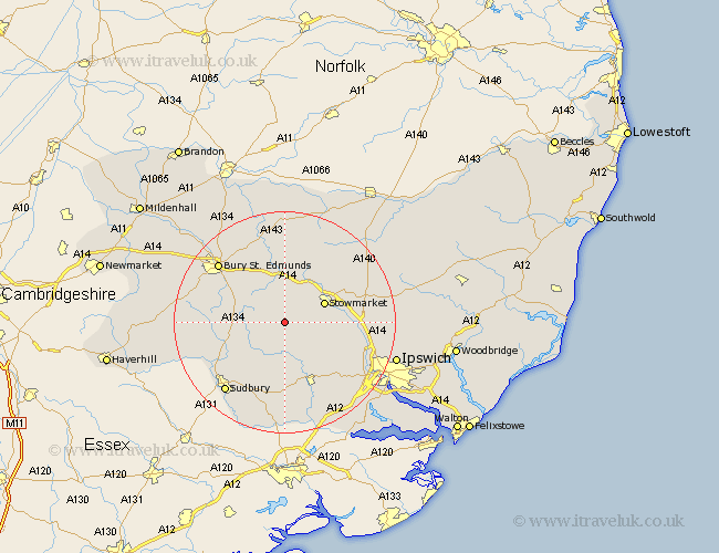
Suffolk Map Showing Location of Brettenham
Population: 243
District: Babergh
Easting: 597240 Northing: 254156
Latitude: 52.15 Longitude: 0.88
 = Brettenham
District: Babergh
Easting: 597240 Northing: 254156
Latitude: 52.15 Longitude: 0.88
= Brettenham
This Brettenham map below is supplied by Google. Use the tools in the top left corner to zoom into street level or zoom out for a road map, you may also need to zoom in to see Brettenham on the map. Click and drag the map to move around. If the map fails to load try and refresh your browser or zoom in or out (+ or -).
Update - it seems Google no longer allow people to use their maps for free! This Brettenham map sometimes loads and sometimes gives a error. I am working on a solution.
Closest 30 Towns or Cities to Brettenham (Population over 500)
Rattlesden 3.7km Hitcham 3.87km Finborough 3.88km Great Finborough 3.88km Bildeston 6.01km Cockfield 6.82km Ringshall 7.07km Woolpit 7.5km Stowmarket 7.76km Great Bricett 7.77km Bradfield St. George 7.95km Bradfield St George 7.95km Bradfield 7.95km Bradfield Saint George 7.95km Lavenham 7.95km Elmswell 9.54km Haughley 10.07km Lawshall 10.23km Rushbrooke 10.88km Norton 11.18km Great Waldingfield 11.51km Waldingfield 11.51km Old Newton 11.73km Thurston 12.01km Hadleigh 12.02km Somersham 12.66km Pakenham 13.42km Long Melford 14.67km Boxford 14.87km Badwell Ash 14.99km