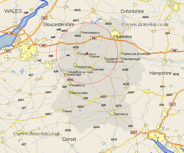
Wiltshire Map Showing Location of Bremhill
Population: 916
District: North Wiltshire
Easting: 397684 Northing: 172389
Latitude: 51.45 Longitude: -2.03
 = Bremhill
District: North Wiltshire
Easting: 397684 Northing: 172389
Latitude: 51.45 Longitude: -2.03
= Bremhill
This Bremhill map below is supplied by Google. Use the tools in the top left corner to zoom into street level or zoom out for a road map, you may also need to zoom in to see Bremhill on the map. Click and drag the map to move around. If the map fails to load try and refresh your browser or zoom in or out (+ or -).
Update - it seems Google no longer allow people to use their maps for free! This Bremhill map sometimes loads and sometimes gives a error. I am working on a solution.
Closest 30 Towns or Cities to Bremhill (Population over 500)
Calne 2.96km Hillmarton 4.98km Hilmarton 4.98km Christian Malford 5.68km Chippenham 5.78km Sutton Benger 6.55km Cherhill 6.86km Laycock 8.02km Lacock 8.02km Lyneham 8.73km Corsham 9.43km Great Somerford 9.55km Somerford 9.55km Roundway 9.89km Stanton St. Quintin 10.15km Stanton Saint Quintin 10.15km Stanton 10.15km Stanton St Quintin 10.15km Bishops Cannings 10.92km Rowde 11.12km Melksham 11.57km Brinkworth 11.65km Devizes 11.65km Seend 11.65km Broad Town 12.12km Yatton Keynell 12.13km Hullavington 12.29km Wooton Bassett 13.08km Wootton Bassett 13.08km Lea 13.18km