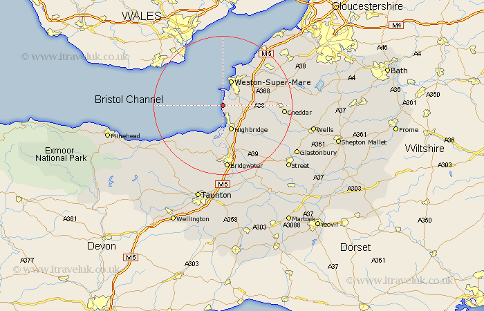
Somerset Map Showing Location of Brean
Population: 691
District: Sedgemoor
Easting: 329103 Northing: 154342
Latitude: 51.28 Longitude: -3.02
 = Brean
District: Sedgemoor
Easting: 329103 Northing: 154342
Latitude: 51.28 Longitude: -3.02
= Brean
This Brean map below is supplied by Google. Use the tools in the top left corner to zoom into street level or zoom out for a road map, you may also need to zoom in to see Brean on the map. Click and drag the map to move around. If the map fails to load try and refresh your browser or zoom in or out (+ or -).
Update - it seems Google no longer allow people to use their maps for free! This Brean map sometimes loads and sometimes gives a error. I am working on a solution.
Closest 30 Towns or Cities to Brean (Population over 500)
Berrow 1.84km Lympsham 4.64km Bleadon 4.99km Brent Knoll 5.08km Burnham-on-Sea 5.68km Burnham 5.68km Burnham on Sea 5.68km Hutton 6.88km Highbridge 7.76km Weston-Super-Mare 7.77km Huntspill 9.55km Locking 10.81km Mark 10.99km Banwell 11.07km Pawlett 11.18km Otterhampton 12.05km Weare 12.89km Wick St. Lawrence 13.11km Wick Saint Lawrence 13.11km Wick St Lawrence 13.11km Puriton 13.42km Stogursey 13.77km Stoke Courcy 13.77km Stokscourey 13.77km Sandford 13.9km Axbridge 15.07km Shipham 15.18km Wedmore 15.77km Churchill 16.05km Cossington 16.38km