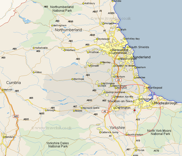
Durham Map Showing Location of Egglescliffe
Population: 7908
Easting: 442073 Northing: 513694
Latitude: 54.52 Longitude: -1.35
 = Egglescliffe
Easting: 442073 Northing: 513694
Latitude: 54.52 Longitude: -1.35
= Egglescliffe
This Egglescliffe map below is supplied by Google. Use the tools in the top left corner to zoom into street level or zoom out for a road map, you may also need to zoom in to see Egglescliffe on the map. Click and drag the map to move around. If the map fails to load try and refresh your browser or zoom in or out (+ or -).
Update - it seems Google no longer allow people to use their maps for free! This Egglescliffe map sometimes loads and sometimes gives a error. I am working on a solution.
Closest 30 Towns or Cities to Egglescliffe (Population over 500)
Eaglescliffe 1.85km Yarm-on-Tees 1.85km Yarm 1.85km Yarm on Tees 1.85km Thornaby-on-Tees 3.72km Thornaby 3.72km Thornaby on Tees 3.72km Stockton-on-Tees 7.42km Stockton 7.42km Stockton on Tees 7.42km Carlton 8.08km Billingham on Tees 9.81km Billingham 9.81km Billingham-on-Tees 9.81km Stillington 10.71km Grindon 11.33km Hurworth 11.38km Wolviston 11.92km Darlington 14.1km Greatham 14.99km Sedgefield 15.77km Newton Aycliffe 17.86km Elwick 19.02km Fishburn 19.29km Bishop Middleham 20.42km Hartlepool 20.42km Trimdon 20.83km Hutton Henry 22.24km Ferryhill 22.57km Hart 22.88km