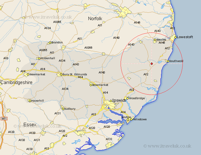
Suffolk Map Showing Location of Bramfield
Population: 369
District: Suffolk Coastal
Easting: 640787 Northing: 274654
Latitude: 52.32 Longitude: 1.53
 = Bramfield
District: Suffolk Coastal
Easting: 640787 Northing: 274654
Latitude: 52.32 Longitude: 1.53
= Bramfield
This Bramfield map below is supplied by Google. Use the tools in the top left corner to zoom into street level or zoom out for a road map, you may also need to zoom in to see Bramfield on the map. Click and drag the map to move around. If the map fails to load try and refresh your browser or zoom in or out (+ or -).
Update - it seems Google no longer allow people to use their maps for free! This Bramfield map sometimes loads and sometimes gives a error. I am working on a solution.
Closest 30 Towns or Cities to Bramfield (Population over 500)
Wenhaston 1.13km Holton 2.17km Halesworth 4.34km Cookley 5.66km Yoxford 5.67km Wangford 6.77km Reydon 9.79km Southwold 10.36km Saxmundham 11.35km Laxfield 11.48km Wrentham 12.6km Leiston 13.17km Snape 15.01km Worlingham 15.21km Bungay 15.86km Fressingfield 16.28km Kessingland 16.69km Dennington 16.81km Beccles 16.83km Framlingham 17.57km Thorpeness 17.62km Thorpe 17.62km Gisleham 17.97km Stradbroke 18.13km Carlton Colville 18.65km Aldeburgh 19.08km Worlingworth 20.06km Tunstall 21.17km Wickham Market 21.73km Hoxne 22.95km