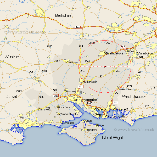
Hampshire Map Showing Location of Bradley
Population: 95
District: Basingstoke and Deane
Easting: 464084 Northing: 141285
Latitude: 51.17 Longitude: -1.08
 = Bradley
District: Basingstoke and Deane
Easting: 464084 Northing: 141285
Latitude: 51.17 Longitude: -1.08
= Bradley
This Bradley map below is supplied by Google. Use the tools in the top left corner to zoom into street level or zoom out for a road map, you may also need to zoom in to see Bradley on the map. Click and drag the map to move around. If the map fails to load try and refresh your browser or zoom in or out (+ or -).
Update - it seems Google no longer allow people to use their maps for free! This Bradley map sometimes loads and sometimes gives a error. I am working on a solution.
Closest 30 Towns or Cities to Bradley (Population over 500)
Medstead 5.68km Dummer 5.94km Four Marks 6.03km North Waltham 7.89km Alton 7.9km Upton Grey 8.04km Upper Farringdon 10.18km Farringdon 10.18km Faringdon 10.18km New Alresford 10.95km Ropley 11.12km Basingstoke 11.12km Oakley 11.59km Froyle 11.62km Basing 11.65km Long Sutton 11.84km Micheldever 13.32km Overton 13.77km Odiham 13.96km Selborne 13.99km Binsted 14.07km Cheriton 14.22km Hook 14.49km Bramdean 15.01km Bentley 15.22km Rotherwick 15.3km Sherfield 15.53km Sherfield upon Loddon 15.53km Kingsley 16.11km Wonston 16.38km