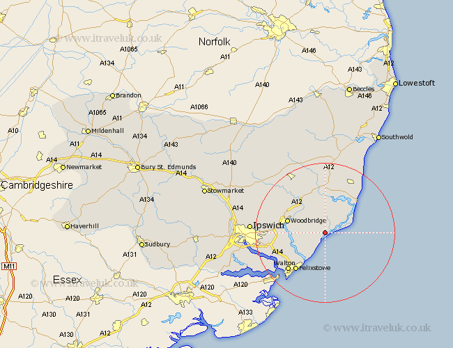
Suffolk Map Showing Location of Boyton
Population: 154
District: Suffolk Coastal
Easting: 637576 Northing: 246643
Latitude: 52.07 Longitude: 1.47
 = Boyton
District: Suffolk Coastal
Easting: 637576 Northing: 246643
Latitude: 52.07 Longitude: 1.47
= Boyton
This Boyton map below is supplied by Google. Use the tools in the top left corner to zoom into street level or zoom out for a road map, you may also need to zoom in to see Boyton on the map. Click and drag the map to move around. If the map fails to load try and refresh your browser or zoom in or out (+ or -).
Update - it seems Google no longer allow people to use their maps for free! This Boyton map sometimes loads and sometimes gives a error. I am working on a solution.
Closest 30 Towns or Cities to Boyton (Population over 500)
Hollesley 2.94km Orford 4.92km Rendlesham 6.52km Tunstall 7.49km Sutton 7.97km Ufford 9.72km Melton 10.9km Woodbridge 10.9km Wickham Market 11.51km Martlesham 11.54km Martlesham Heath 12.53km Kirkton 12.66km Kirton 12.66km Aldeburgh 12.99km Snape 13.16km Felixstowe 13.69km Walton 14.98km Thorpeness 15.12km Thorpe 15.12km Grundisburgh 15.26km Bucklesham 15.27km Leiston 16.32km Saxmundham 16.83km Nacton 16.9km Otley 18.43km Shotley 18.53km Framlingham 19km Chelmondiston 19.46km Witnesham 19.71km Wirnesham 19.71km