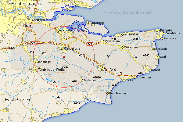
Kent Map Showing Location of Boughton Monchelsea
Population: 2041
District: Maidstone
Easting: 576904 Northing: 149495
Latitude: 51.22 Longitude: 0.53
 = Boughton Monchelsea
District: Maidstone
Easting: 576904 Northing: 149495
Latitude: 51.22 Longitude: 0.53
= Boughton Monchelsea
This Boughton Monchelsea map below is supplied by Google. Use the tools in the top left corner to zoom into street level or zoom out for a road map, you may also need to zoom in to see Boughton Monchelsea on the map. Click and drag the map to move around. If the map fails to load try and refresh your browser or zoom in or out (+ or -).
Update - it seems Google no longer allow people to use their maps for free! This Boughton Monchelsea map sometimes loads and sometimes gives a error. I am working on a solution.
Closest 30 Towns or Cities to Boughton Monchelsea (Population over 500)
Boughton Monchelsea 0km Linton 1.16km Loose 2.18km Langley 3.94km Sutton Valence 3.95km Hunton 3.95km Maidstone 5.68km Barming 5.94km East Barming 5.94km Bearsted 6.02km Marden 6.02km Leeds 6.09km Yalding 6.96km Staplehurst 7.42km Boxley 7.5km Detling 8.18km Aylesford 8.18km Ulcombe 8.34km East Malling 8.91km Hollingbourne 8.93km Wateringbury 8.93km Headcorn 9.42km Frittenden 9.91km Harrietsham 10.61km East Peckham 10.61km Burham 11.65km Paddock Wood 11.84km Addington 11.87km West Malling 11.88km Mereworth 12.18km