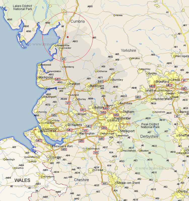
Lancashire Map Showing Location of Borwick
Population: 210
District: Lancaster
Easting: 353177 Northing: 471084
Latitude: 54.13 Longitude: -2.72
 = Borwick
District: Lancaster
Easting: 353177 Northing: 471084
Latitude: 54.13 Longitude: -2.72
= Borwick
This Borwick map below is supplied by Google. Use the tools in the top left corner to zoom into street level or zoom out for a road map, you may also need to zoom in to see Borwick on the map. Click and drag the map to move around. If the map fails to load try and refresh your browser or zoom in or out (+ or -).
Update - it seems Google no longer allow people to use their maps for free! This Borwick map sometimes loads and sometimes gives a error. I am working on a solution.
Closest 30 Towns or Cities to Borwick (Population over 500)
Over Kellet 2.14km Warton 3.26km Carnforth 3.74km Nether Kellet 4.29km Bolton le Sands 7.05km Caton 7.41km Silverdale 7.5km Lancaster 11.17km Morecambe 11.42km Morecombe 11.42km Overton 17.19km Middleton 18.38km Forton 20.84km Cockerham 21.4km Pilling 25.79km Garstang 26.15km Preesall 29.1km Chipping 29.13km Claughton-on-Brock 29.64km Claughton on Brock 29.64km Claughton 29.64km Catterall 29.82km Fleetwood 31.61km Hambleton 32.86km Eccleston 32.99km Great Eccleston 32.99km Waddington 34.02km Inskip 34.22km Longridge 34.48km Grindleton 34.58km