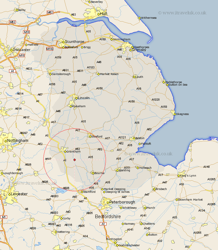
Lincolnshire Map Showing Location of Boothby Pagnell
Population: 150
District: South Kesteven
Easting: 497634 Northing: 329076
Latitude: 52.85 Longitude: -0.55
 = Boothby Pagnell
District: South Kesteven
Easting: 497634 Northing: 329076
Latitude: 52.85 Longitude: -0.55
= Boothby Pagnell
This Boothby Pagnell map below is supplied by Google. Use the tools in the top left corner to zoom into street level or zoom out for a road map, you may also need to zoom in to see Boothby Pagnell on the map. Click and drag the map to move around. If the map fails to load try and refresh your browser or zoom in or out (+ or -).
Update - it seems Google no longer allow people to use their maps for free! This Boothby Pagnell map sometimes loads and sometimes gives a error. I am working on a solution.
Closest 30 Towns or Cities to Boothby Pagnell (Population over 500)
Ropsley 4.33km Corby 5.99km Colsterworth 7.14km Grantham 7.89km Harlaxton 9.14km Belton 9.85km Folkingham 10.24km Barrowby 10.53km Great Gonerby 10.78km South Witham 11.99km Rippingale 12.86km Castle Bytham 13.02km Ancaster 13.02km Morton 14.38km Allington 14.52km Bourn 14.54km Bourne 14.54km Pointon 14.55km Billingborough 15.01km Sleaford 18.49km Long Bennington 18.66km Caythorpe 18.84km Helpringham 19.16km Thurlby 19.28km Fulbeck 20.5km Leasingham 20.58km Heasingham 20.58km Hale 21.06km Great Hale 21.06km Cranwell 21.13km