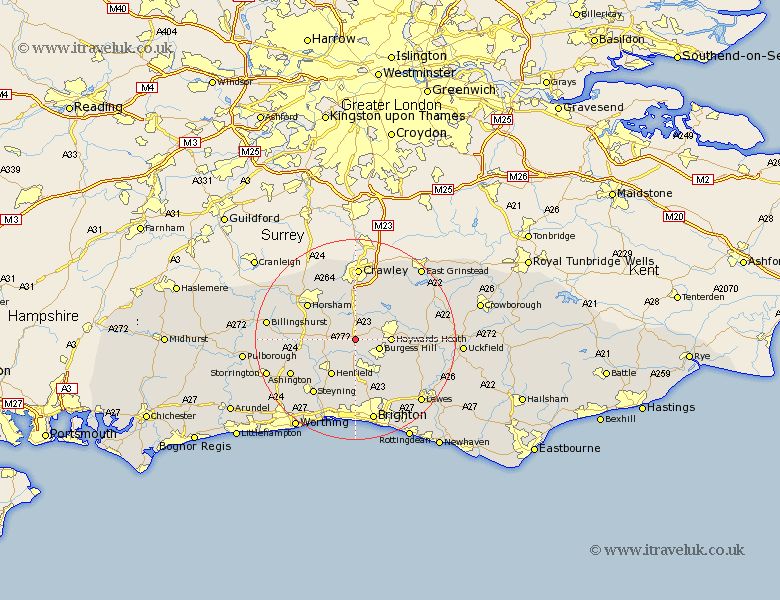
Sussex Map Showing Location of Bolney
Population: 1209
District: Mid Sussex
Easting: 526334 Northing: 122035
Latitude: 50.98 Longitude: -0.2
 = Bolney
District: Mid Sussex
Easting: 526334 Northing: 122035
Latitude: 50.98 Longitude: -0.2
= Bolney
This Bolney map below is supplied by Google. Use the tools in the top left corner to zoom into street level or zoom out for a road map, you may also need to zoom in to see Bolney on the map. Click and drag the map to move around. If the map fails to load try and refresh your browser or zoom in or out (+ or -).
Update - it seems Google no longer allow people to use their maps for free! This Bolney map sometimes loads and sometimes gives a error. I am working on a solution.
Closest 30 Towns or Cities to Bolney (Population over 500)
Cowfold 4.67km Burgess Hill 5.02km Lower Beeding 5.1km Slaugham 5.56km Albourne 5.68km South Nutfield 5.96km Cuckfield 5.96km Baywards Heath 7km Haywards Heath 7km Nuthurst 7.24km Hurstpierpoint 7.76km Hassocks 8.76km Keymer 8.76km Henfield 8.76km Wivelsfield 8.97km Balcombe 9.43km Lindfield 9.51km West Grinstead 9.52km Ardingly 9.88km Ditchelling 10.19km Ditchling 10.19km Southwater 11.13km Shipley 11.81km Horsham 11.92km West Horsham 11.92km Horsted Keynes 13.36km Worth 13.79km Rusper 13.79km Turners Hill 13.79km Steyning 13.8km