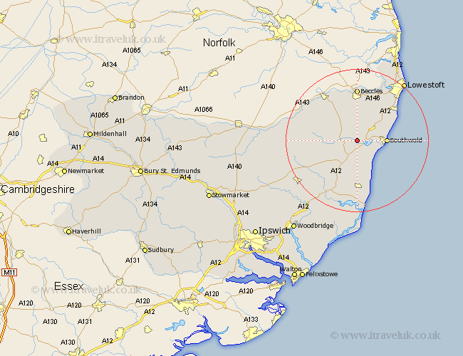
Suffolk Map Showing Location of Blyford
Population: 110
District: Waveney
Easting: 642968 Northing: 276611
Latitude: 52.33 Longitude: 1.57
 = Blyford
District: Waveney
Easting: 642968 Northing: 276611
Latitude: 52.33 Longitude: 1.57
= Blyford
This Blyford map below is supplied by Google. Use the tools in the top left corner to zoom into street level or zoom out for a road map, you may also need to zoom in to see Blyford on the map. Click and drag the map to move around. If the map fails to load try and refresh your browser or zoom in or out (+ or -).
Update - it seems Google no longer allow people to use their maps for free! This Blyford map sometimes loads and sometimes gives a error. I am working on a solution.
Closest 30 Towns or Cities to Blyford (Population over 500)
Wenhaston 2.17km Holton 3.4km Wangford 3.87km Halesworth 4.9km Reydon 7.04km Southwold 7.93km Cookley 8.14km Yoxford 8.15km Wrentham 9.68km Worlingham 13.03km Saxmundham 13.74km Kessingland 13.77km Laxfield 14.09km Leiston 14.82km Beccles 14.83km Gisleham 15.08km Bungay 15.2km Carlton Colville 15.82km Snape 17.29km Fressingfield 18.21km Thorpe 18.83km Thorpeness 18.83km Dennington 19.59km Oulton 20.15km Stradbroke 20.47km Framlingham 20.5km Aldeburgh 20.51km Lowestoft 20.8km Worlingworth 22.77km Tunstall 23.62km