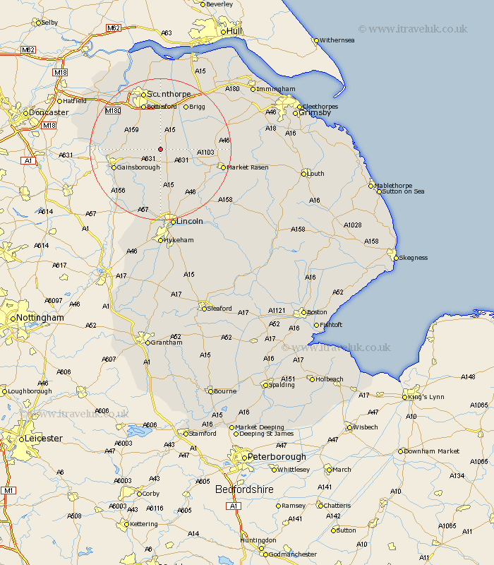
Lincolnshire Map Showing Location of Blyborough
Population: 110
District: West Lindsey
Easting: 494106 Northing: 393909
Latitude: 53.43 Longitude: -0.58
 = Blyborough
District: West Lindsey
Easting: 494106 Northing: 393909
Latitude: 53.43 Longitude: -0.58
= Blyborough
This Blyborough map below is supplied by Google. Use the tools in the top left corner to zoom into street level or zoom out for a road map, you may also need to zoom in to see Blyborough on the map. Click and drag the map to move around. If the map fails to load try and refresh your browser or zoom in or out (+ or -).
Update - it seems Google no longer allow people to use their maps for free! This Blyborough map sometimes loads and sometimes gives a error. I am working on a solution.
Closest 30 Towns or Cities to Blyborough (Population over 500)
Kirton 3.87km Kirton in Lindsey 3.87km Waddingham 4.79km Scotton 5.77km Scotter 7.83km Hibaldstow 8.12km Blyton 8.83km South Kelsey 10.6km Ingham 11.12km Willingham 11.39km Scawby 11.6km Messingham 11.96km North Kelsey 12.36km Lea 13.3km Owston Ferry 13.35km Owston 13.35km Gainesborough 13.36km Gainsborough 13.36km Bottesford 13.71km Morton 13.76km Brigg 14.57km Scampton 14.86km Scrampton 14.86km Broughton 15km Middle Rasen 15.4km Welton 16.24km Marton 16.34km Wrawby 16.72km Dunholme 16.72km Dunholm 16.72km