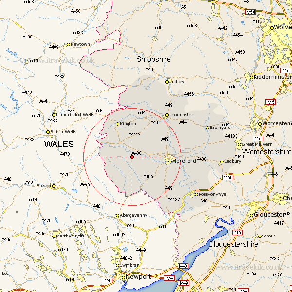
Herefordshire Map Showing Location of Blakemere
Population: 76
Easting: 336028 Northing: 241382
Latitude: 52.07 Longitude: -2.93
 = Blakemere
Easting: 336028 Northing: 241382
Latitude: 52.07 Longitude: -2.93
= Blakemere
This Blakemere map below is supplied by Google. Use the tools in the top left corner to zoom into street level or zoom out for a road map, you may also need to zoom in to see Blakemere on the map. Click and drag the map to move around. If the map fails to load try and refresh your browser or zoom in or out (+ or -).
Update - it seems Google no longer allow people to use their maps for free! This Blakemere map sometimes loads and sometimes gives a error. I am working on a solution.
Closest 30 Towns or Cities to Blakemere (Population over 500)
Peterchurch 3.88km Madley 6.8km Eardisley 8.69km Kingstone 8.81km Credenhill 9.83km Almeley 9.87km Allensmore 11.67km Burghill 11.98km Clifford 11.98km Weobley 12.02km Ewyas Harold 13.42km Dilwyn 13.74km Moreton 14.16km Moreton on Lugg 14.16km Moreton-on-Lugg 14.16km Wellington 14.55km Hereford 14.93km Lyonshall 15.21km Bullingham 15.27km Much Dewchurch 15.6km Kington 15.88km Pembridge 16.83km Sutton 17.48km Eardisland 17.62km Much Birch 18.53km Lugwardine 19.37km Bodenham 19.42km Mordiford 20.59km Withington 20.83km Shobdon 20.88km