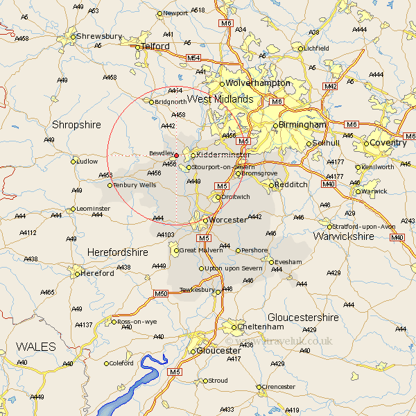
Worcestershire Map Showing Location of Bewdley
Population: 8822
Area Size (ha): 209
District: Wyre Forest
Easting: 378448 Northing: 276230
Latitude: 52.38 Longitude: -2.32
 = Bewdley
Area Size (ha): 209
District: Wyre Forest
Easting: 378448 Northing: 276230
Latitude: 52.38 Longitude: -2.32
= Bewdley
This Bewdley map below is supplied by Google. Use the tools in the top left corner to zoom into street level or zoom out for a road map, you may also need to zoom in to see Bewdley on the map. Click and drag the map to move around. If the map fails to load try and refresh your browser or zoom in or out (+ or -).
Update - it seems Google no longer allow people to use their maps for free! This Bewdley map sometimes loads and sometimes gives a error. I am working on a solution.
Closest 30 Towns or Cities to Bewdley (Population over 500)
Kidderminster 4.52km Stourport 5.02km Stourport-on-Severn 5.02km Stourport on Severn 5.02km Arley 6km Upper Arley 6km Rock 7.93km Hartlebury 7.93km Stone 8.13km Astley 9.26km Churchill 9.78km Abberley 9.87km Chaddesley Corbett 10.84km Great Witley 11.35km Lindridge 12.6km Belbroughton 13.7km Clent 14.07km Ombersley 14.15km Hagley 14.66km Great Dodford 15.17km Dodford 15.17km Holt 15.5km Stourbridge 15.51km Clifton upon Teme 16.31km Clifton 16.31km Martley 17.02km Droitwich 17.22km Grimley 17.28km Bromsgrove 17.86km Lickey End 18.2km